Distance: 42.7km (70.0km).
The next church after Hovin is at Austbygde, some 30km between them. I have already eaten up some of those kilometres, so less to go. The day will however not be finished at Austbygde church, so more to go still. From Austbygde, the proposed route has been altered, a note at Hovin church told me that it was impossible to go down from the road the pilgrim way was going on to the church. This means that the walk up to Austbygde church from Austbygde will be a round trip.

Bråtådokktjønn in the morning.
That is still some hours away from when I wake up in my tent to a quiet lake in the morning. Even the annoying hoard of mosquitos and gnats from yesterday evening is quiet as I prepare my breakfast and morning coffee.

The path over Ramnskardåsen.
This part of the pilgrim path is following what is called Gamle Hovinvegen, an old way that now goes past pines, rocky outcrops, and bogs on its course over Ramnskardåsen. The walk is scenic and pleasant, a fine start to the walk of today.

More creek than path, this wet section was just before getting to the Sønstevatn lake.
When walking a trail that you at first hand was a little bit sceptic of, there is nothing better than to find out that you actually are enjoying yourself when you are walking it.

De Kvite Kyrkjene pilgrim path going past Bjortjønn.

Bjortjønn lake.
Coming down from the Ramnskardåsen hill, I find myself walking through an area with some scattered cabins around. The walk has changed from going on a foot path to a forest track as it passes by a string of lakes, Sønstevatn, Heivatn, Bjortjønn and Tovstjønn. Relaxing views for the eyes.

Tovstjønn with its tiny island.
Gamle Heie Skule is an old school the pilgrim path passes by, which stood ready for use in 1886. It provided education of the kids in the surrounding area until 1958 when it closed. For some the walk to the school was both long and steep. It is now being used as a school museum. Looking through the windows, I can see the old furniture from the time it was in use, musing on how different the education probably was in comparison to my own.

Telemark farms.

The old school house at Gamle Heie Skule.
This part of the pilgrim path follows gravel tracks, forest roads and some few paths in between. The path crosses over a creek called Lengstebekk (which translates to ‘The Longest Creek’). A short walk on a paved road (the same road we used to get to my starting point yesterday) has to be tolerated to get to the final section of the walk before reaching Austbygde. Fortunately, that section is a very pleasant one (not the walk on the paved road of course).

Lomtjønn.
Leaving the road, there is a short walk on a gravel track past the Hafoss lake with its cabins. Then crossing over a bog on what appear to be a makeshift boardwalk, and a nicely situated bench with a table in the middle of the bog, it is all forest paths. Midttjønn lake are visible through the trees, while the much larger Gjuvsjå is not.

Hafoss lake.
This is still the old Gamle Hovinvegen way. It is a lovely forest scenery. Sometimes, old and forsaken farms are visible next to the path. Three old bridges are used to cross over running water.

Crossing over a bog after Hafoss, passing by a picnic bench and table in the middle of it.

Gamle Hovinvegen old way.
Before the descent to Austbygde, a small detour takes me up to a hill called Verpenuten with a great view over Tinnsjøen. The detour is marked with a sign ('Utsikt'). Taking the short part on the paved road out of the equation, the walk so far today has been enjoyable. This is a nice addition to it.

A barn or a farm that appears to be no longer in use.
I have been walking a little over 5 hours when I arrive at Austbygde. This village provides the most in terms of services on the pilgrim path. For pilgrims or hikers, it is the food store and the local bakery that will be the primary targets. I stock up on some few supplies and food, then have my lunch at one of the picnic benches. Needed some drinks too, it has been a warm day. Before I continue, I grap a cup of coffee from the bakery.

The pilgrim path passes by these stones that appear to be some kind of old waymarks.
From Austbygde, the pilgrim path has been altered, as I had been given warnings of. Instead of going higher up on the road towards Veggli and then down to Austbygde church from there, you have to go up to the church and back again from the village centre. Normally, the pilgrim path stays higher up, not going down to the village, but people might have to go down anyway, if they are to find accommodation in Austbygde.

Great view over Tinnsjø from Verpenuten.
Going up and back the same way usually does not appeal to me, so I scour the map for possible other ways to go. I do find some options, but in the end, I decide to just follow the same way. It is not an unpleasant walk.

Alt blir bra ('Everything will be fine'), at Austbygde centre.
Before the church in Austbygde was consecrated in 1888, the people living here and in the Tessungdalen valley had to walk to Atrå to get to a church. Where there had been a church since around 1180.

Austbygde church.

On the path between Austbygde and Austbygde church.
If trying to figure out distances walked, the guidebook to the pilgrim path is a little bit confusing around here. As the book describes the walk in three chapters, a roundtrip from the centre of Austbygde to the church and back again, from Austbygde church to Atrå church and from the centre of Austbygde to Mæl church past Atrå church. With all the descriptions overlapping.

One of the 'Tinntrollene' wooden figures ('Tinn Trolls'), overlooking a nice view of Tinnsjøen from above Austbygde on the way towards Atrå.
The walk over to Atrå is a highlight of the day. Pleasantly getting higher up, the path opens up to nice views over Tinnsjøen. Situated next to the path at times, are small wooden figures called Tinntrollene ('The Tinn Trolls'). The best part of the walk is when the pilgrim path enters one of the old church ways ('Gamal kyrkjeveg') that people used to get to Atrå church. The path is wonderful and with a lovely light from the sun at this hour. Old stone walls were built to create this path, winding downwards over stones, moss and heather, also crossing over a bridge on its way.

The old church way to Atrå church with Tinnsjøen lake.
With a somewhat undecidedly plan of walking about 30km a day, this section was where I would have tried to find a place to camp, but I found it too early to stop. Plus, there is also a threat of bad weather tomorrow, so I wanted to see as much as I can before everything gets obscured. I push on towards Atrå.

'Gamal kyrkjeveg' path towards Atrå church.
It is strange to be so happy to see an open shop, but after walking for some time yearning for something other than water to drink, that is exactly what I am when I get to the shop in Atrå. Coming out of the woods, there was no escaping some walk on hard surface.

Atrå church.
The original old church in Atrå was a stave church dating back as far as around 1180. The church I see now was open to the public some 650 years later. Late is the day when I am here, almost half past eight.
Atrå.
Over to Mæl church the walk is similar to that from Austbygde, only that this path goes higher up. The evening sun is upon me as I head up into the hills above. A tunnel of vegetation at times, sometimes lit up by the evening illumination. Passing by a very old loft. Next to the path is a farm that appear forsaken with tall grass around.

A very old loft passed by on the way up into the hills between Atrå and Mæl.
An abandoned looking place or farm. Is there someone watching me from the windows??
After a somewhat steep climb up, I find myself on a forest track and I begin to search for a place for the night. There are some nice fireplaces, but with not so good places for my tent. In the end, I locate a place having to go a little bit down from the track. A sheltered spot between trees on a heather bed.

Evening sun illuminating the path up into Buverudåsen.

Looking back towards Atrå below from the evening climb up into Buverudåsen.
As the sun disappears behind the mountains with a last flare, I have my evening dinner and coffee. The day became a long day, and I am happy for it. It was rather exciting in a way. The Gamal Kyrkjeveg (‘The Old Church Way’) was the definite highlight of the walk, with its beautiful path and light.
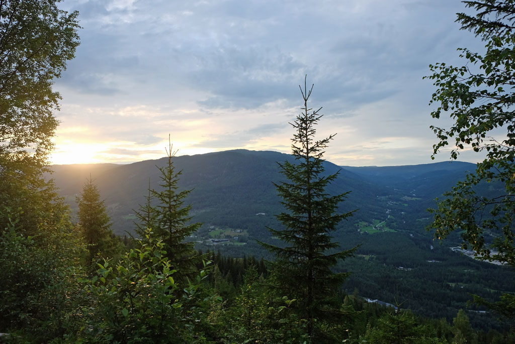
Setting sun from my campsite at Buverudåsen.
<< Bråtådokktjønn // day 1Rjukan // day 3 >>


No comments:
Post a Comment