Sunday, August 7, 2016

Massiv // day 7 // Finnsbergvatnet - Finse

Massiv day 7.
Distance: 16.9km (156.4km), time spent: 6:22 (57:13).
Ascent / descent: 460m (4454m) / 468m (4236m).
Altitude (start / end / highest): 1209m / 1222m / 1429m.
Weather: Mostly grey and overcast, then a deluge, overcast again near the end.


A quick look outside the tent reveals that the morning has not paid any heed to yesterdays glorious evening, a shield has descended upon the sky and is blocking all sunlight. Some drops of rain are also descending. Those two factors does not concern me much, but it would be nice to have one full day with sun and a clear blue sky. I shall however not complain, the weather has been erratic, but is has been far better than what I had expected. Back home before I left, the forecast for this week was anything but positive.

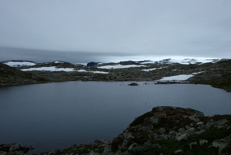
Looking back at Finnsbergvatnet, my campsite was at the other end of the lake.

What I have in store of weather on the way today, carries no significance either. The end of the story and the journey is that I will come to Finse, where I can get a shower and can change into dry clothes. Then I will be sitting on a train. Few concerns. My only slight concern earlier was to reach the train, and even if I had started from Krækkja this morning I would probably have enough time. Now I have more than enough, no need to stress about anything. I have about six hours left of my hike, given the estimates by the Norwegian trekking association of this route.

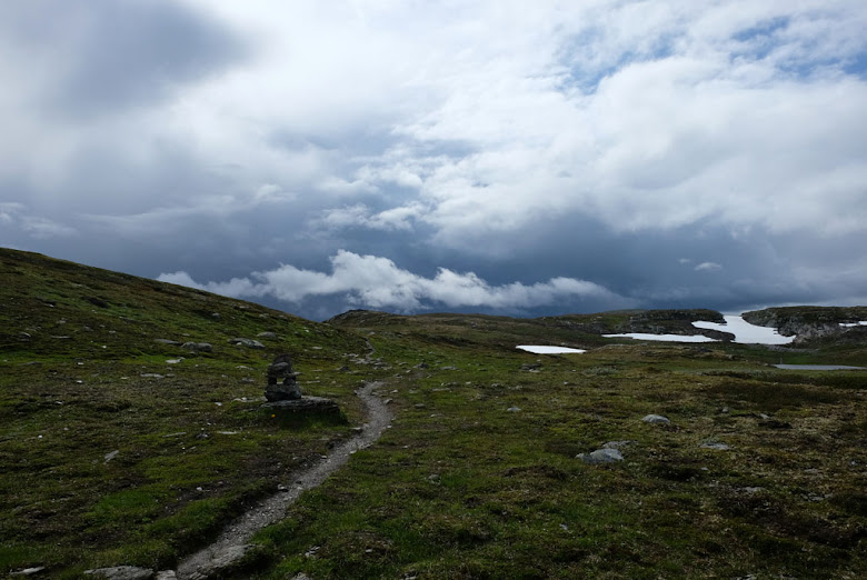
Grey mountain scenery.

One of the few (and small) snow banks between Krækkja and Finse, less snow here on this stretch than it was when I walked here in the Summer of 2012.

In the Winter, it is called a whiteout when the ground and sky blends together in a blizzard, when one fails to distinguish the ground from the sky. With this grey sky and grey landscape, could this be called a greyout? They almost go in one, a landscape almost without color nuances. A stone desolation. Rough and cool.

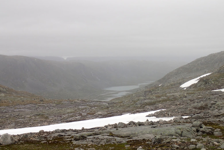
View through the rain down towards where the Rallarvegen passes by Storurevatnene.

For a while I feel utterly alone, where I do not expect to meet anyone until I arrive at Finse. Only Hardangerjøkulen that is keeping half an eye on me, partly hidden by the clouds, but eventually two other hikers appears. Two dark figures that hardly are visible in the landscape. This is their first hike that extends to more than one night, according to them, so they are a little bit excited.

Clouds forming a clear and grey border between land and sky, Hardangerjøkulen partly obscured by the grey weather.

Small light rain showers come and go, apparently only when I take a break. Small and short breaks, small and short rain showers. Before Torsteinsvatnet, the route offers views down towards where Rallarvegen is passing Storurevatnene, but I cannot see if there are any cyclists who are out there in the rain (Rallarvegen is a famous road that it is very popular to go biking on).

Hardangerjøkulen with Blåisen (named after its blue ice).

The full front of the rain does finally arrive, right before I come down to where the path from Kjeldebu joins my route towards Finse. As a wall from the West. With the exception of the evening and night at Reinsmyrtjørna, this is the heaviest of rain that I have had on my hike. Conveniently enough at the time that my stomach has ordered lunch. From Kjeldebu comes first a group of walkers that go with firm steps towards Finse, then a solitary hiker moments later. They do as I do, stands for a short time in the shelter of a rock and eats quickly, before disappearing.

Rain approaching, a grey wall on its way.

The rain subsides somewhat after a little while, so I can sit down and eat more properly. Without any long breaks, as well as I have kept a decent pace, makes me ahead of the schedule. I can take it easy the last kilometers to Finse, vaguely visible through the veil of rain and clouds. The mountains in the horizon are dark. I can see a train leaving the station at Finse.

A short break in the deluge, rolling (smoking) clouds over Vetle Hansbunuten.

I arrive at Finse and the end of Massiv for me this year. Just before I am at the train station there is a train going to Oslo. I might be able to reach it, but my fellow passengers would probably not be so happy about it (getting a smelly and sweat hiker next to them). This is where this years Summer hike in the mountains ends. It has been a great week and a wonderful crossing of Hardangervidda.

At Finsefetene the river is crossed on a suspension bridge, would not want to fall into the water.

With my train ticket in my pocket (for the 18:20 train, I arrived around 14:30), I walk to Finsehytta for a shower, it will be good to shower off the shower I got on my way here. Plenty of time to the train is departing, so overlooking Finsevatnet and the rain, I can sit down and relax with some food and taste the local beer from the microbrewery at the place. I get company by the solitary hiker I met, who is from Germany. This was also his first hike that lasted several days, he was happy with his trip, but was tired and satisfied that he was finished.

Finse and thee end of first part of the Massiv trail for my part.

So, then I leave Finse and Massiv. Someone stole my portable seat pad while I relaxed at the cabin, not exactly a huge loss, but quite petty to steal such a small item if you ask me. The train rolls down, passing cyclists on Rallarvegen, gradually descending. The mountains becomes smaller, more and more trees appears, the vegetation takes over, valleys opens up. Behind me seven days on Hardangervidda and Massiv. Next year, I will hopefully return to Finse, ready to proceed further into Skarvheimen. So long for this time. First time, I have done a 'pub to pub' walk in the mountains.

Map of the trail for the seventh and last day on Massiv, from Finnsbergvatnet to Finse.

<- FinnsbergvatnetGeitryggvatnet ->

Saturday, August 6, 2016

Massiv // day 6 // Stigstu - Finnsbergvatnet

Massiv day 6.
Distance: 26.1km (139.5km), time spent: 9:53 (50:51).
Ascent / descent: 661m (3994m) / 668m (3768m).
Altitude (start / end / highest): 1223m / 1209m / 1362m.
Weather: Fog in the morning, then overcast, evening sun.


A small gust goes through my body when I cross the courtyard between the annex and the main cabin at Stigstu. Outside, the fog is dense, as in a fairy tale. It is almost as if the fog seeps through tiny openings in the walls and windows. The guests sits down inside in front of the breakfast table, yesterday they gathered, today they became separated again, each to their own direction.

Stigstu shrouded by fog in the morning.

That I will not be spending the night at Krækkja is decided, but that does not mean that I will not pay a visit to the cabin. In a way, you could say that I have fallen into a routine now, hike to a staffed cabin, take a break and then continue on to find a place to camp (and get a stamp in Massiv passport).

Mistwalkers on the moorland above Stigstu.

Last time I went here, between Krækkja and Stigstu, was in the winter-summer of 2012. At that time, there were a lot of snow in the mountains, although it was more modest here than in other areas. I cannot see any snow now, just the fog lying thick above the ground. Still, the fog is not as thick as pea soup, the path is clearly visible, though you do not see that far. I had better views that summer, so it does not matter that I wander amongst gnomes and fairies today, rather than looking at distant mountains.

A window in the mist. The valley below Skaupsjøbrotet appears underneath the clouds for a short while.

Stigstu disappeared at least quickly in the fog, and if someone stood and watched me when I left the cabin, they probably just saw a solitary figure who disappeared among the clounds, slowly swallowed up by them. Above the moorland clouds are drifting, slight howls from the wind and occasionally small glimpses of view. Small lakes and ponds appears and sinks back into oblivion.

Above Lundhaukedalen, the fog has lifted somewhat and more and more views remains.

Behind me, I am being chased by a group that yesterday came from Rauhelleren, in front a dog is dragging on the rains, apparently it does not like having people walking in front of him. Competitive instinct at large. We talked together a great day yesterday and at the breakfast table today; and after they overtake me, we walk for some time together talking along the way. With lighter backpacks and not hindered by an equal desire to take pictures, they gradually disappears into the fog and the cloudy landscape. I overtake them one last time, when they stop for a lunch break, and then they disappear for good when I stop for my lunch by Skulevikåne. For them the journey ends at Halne.

On the way towards Halne with Halnekongen visible behind, the road barely visible as a thin line.

At Lundhaukedalen, the clouds have been lifted higher up into the sky, the landscape in the horizon is greeting me welcome. Highway 7 (R7) at Halne marks a nice border between the flat eastern part of Hardangervidda and the more torn scenery where Massiv is approaching Skarvheimen. After walking a long way from any high trafficked road for some time, you have to remember to look around when crossing the road. I have no wish to stay long next to the road (or any road), to I quickly walk on. The most distinctive landmark here, Halnekongen, has long been visible.

After Halne Fjellstova, the trail slips into a more rocky, gnarled and rugged landscapes when Massive is approaching Skarvheimen.

Halnekongen is tempting me, but I continue on, resisting the temptation. The top beckons again, I have to take time to think, but resists the temptation again. The clouds does not resist the temptation, they often climb up to gaze out over the landscape. As I does, over the more gnarled scenery above Krækkja.

At Krækkja, the cabin is being improved, the place looking like a construction site more than a tranquil place in the mountains. Even though the cabin is getting bigger, there will be no more places to sleep there. Not allowed, a bit baffling given that the Norwegian trekking association (DNT) still has the unwritten rule that no one is to be turned away even if it is full. Which means that the only difference is that people have to sleep on mattresses on the floor instead of a bed. The point is, if people are determined to get out and know they we will get a shelter for the night, fewer beds available will not prevent them from coming.

On the way down from Halnebotnane where you can look down at Krækkja. From here, the construction works at the cabin is clearly visible.

I arrive at DNT's staffed construction site together with another hiker, who turns out to be married to the hostess at Fagerheim Fjellstugu. They have a full house today he tells over a cup of coffee, as opposed to here, but it will probably be more people here eventually. When he walks on to return to Fagerheim to help with the evening dinner there, I sit down in the fireplace lounge with a cold beer (heard that before?). The lounge is untouched by the work, except for some scaffolding outside the window.

A rocky landscape, a lonesome hiker and dramatic clouds greets me between Drageidfjorden and Finnsbergvatnet.

Leaving Krækkja, I go with the expectation that it will rain, ominous clouds lies heavily over the mountains and Hardangerjøkulen (the famous glacier in the north of Hardangervidda), ready to drop its load. At Drageidfjorden, I meet some of those who have hiked the long way from Finse, expectant of soon reaching Krækkja. For me, the trek is head, past Drageidfjorden, rocky mounds and small suspension bridges over babbling rivers and streams. Dramatic clouds, the world in dark hues.

Roughly two hours later I come to Finnsbergvatnet, at a convenient time to stop for the day. At the southeastern end of the lake is a good campground, with nice views of the lake and towards Helveteshorga with Hardangerjøkulen as background. When the backpack is on the ground and the tent brought out, I only wait for the first raindrops to appear, but instead the layer of clouds are breaking up in the west.

A wonderful evening sun above Finnsbergvatnet when dinner is prepared.

What follows is the finest evening of the trip so far, it is also the last night. When I sit outside preparing the dinner there is a great evening sun over Helveteshorga and Finnsbergvatnet. The clouds disappears rapidly and above me blue sky is making its entry, while in the horizon the clouds lie like waves across the mountain, just not moving.

Evening at Finnsbergvatnet.

In the evening, when the sun has disappeared behind the glacier, and the verge of the mountains has assummed a reddish hue, the temperature drops again. I creep into the tent and relax before the night closes on the landscape. From fog to a lovely evening sun, a varied day where I have moved from Hardangervidda towards Skarvheimen.

Map of the trail for the sixth day on Massiv, from Stigstu to Finnsbergvatnet.

<- StigstuFinse ->

Friday, August 5, 2016

Massiv // day 5 // Reinsmyrtjørna - Stigstu

Massiv day 5.
Distance: 18.6km (113.4km), time spent: 6:35 (40:58).
Ascent / descent: 282m (3333m) / 358m (3100m).
Altitude (start / end / highest): 1297m / 1223m / 1301m.
Weather: Yet another day with undetermined weather, but the hottest one so far, fog in the evening.


I cannot claim that it is cheerful outside when I wake up in the morning, but the rain eventually stopped during the night. On the ground outside the tent it is wet and it makes some nice gurgling sounds when you step on it some places. From the inside of my tent, the raindrops lying on the canvas looks like tiny rivers that runs downwards. After having eaten more of my dwindling storage of food for breakfast and lunch, I pack together my belongings. To make the tent lighter, I separate the inner tent from the outer tent and shakes both parts well.

Rain moving across the flat areas on the eastern part of Hardangervidda, here from Eiriksbudalen. It is not many obstacles for the weather in this part, so it whizzes almost unobstructedly across the mountain.

Having considered my options, I have today decided to go to Stigstu. If I spend my planned for second night on a cabin at Krækkja, I will get a longer walk to Finse on sunday. I have to reach the train back home again, to continue from Krækkja and spend the night in my tent instead, provide me with a better time to reach the train. Hence, less stress. Another argument is that if I continue from Stigstu, then tomorrow will be a really short day.

What is this pole with two arms that reaches towards the sky? Langavatnet is below.

This section of Massiv has now moved into the eastern part of Hardangervidda. I know about a much tougher route across the plateau to Finse when it comes to the scenery, but on the other hand, the decision to route the trail past Stigstu and Krækkja provides the hikers with a taste of the more flat landscape on this part of Hardangervidda. Not that it is without its own charm, but for a more massive trail, I would have made the trail go past Hadlaskard, Liseth and Rembesdalseter before Finse. Though, this maybe breaks the concept of passing by as many staffed cabins at possible.

Langavatnet with a view to the west.

The flat landscape makes the weather pass faster by, in an already grey view it begins to rain, but it disappears quickly further away into the horizon. Like the weather, I also walk quickly on this surface. There are few meters of ascent and descent to speak of. On the small hilltop before Langavatnet, I pass by an odd pole, with two arms that reaches up towards the weather, I wonder strangely upon what it is.

One of the hunting lodges at Hellehalsen above Langavatnet, by looking at the walls you can see that it is weather-beaten here.

Down by Langavatnet, where the outlet between the lake and Kristentjønn is crossed on a large bridge, I encounter the first of the other walkers for the day, it is a short distance from the parking lot at Tinnhølen and here. In addition, there are more people on the path here than I have met earlier on the walk.

For many, many years ago, I was also crossing the mountain plateau, together with my cousin and two of his friends. Just above Hellehalsen we met three exhausted hikers who all walked with their backs bent, each carrying a heavy load. After we had talked to them for a while, they continued further. When we looked at their backpacks, we understood the crooked backs, they were all carrying their own three liter bag of wine. Later, I read an article in an Norwegian newspaper about crossing Hardangervidda. At the end of the article, there were a small notice that carrying with you three liter of wine was not a good idea. My backpack is far too heavy as it is now, and I do not carry with me any wine.

Contrasts between land and sky in the mountains, just after Tinnhølen / Trondsbu towards Stigstu.

Path towards Stigstu with Skaupsjønuten behind.

Getting to the parking place at Tinnhølen is an anticlimax, a sea of cars, both usual and caravans. Reminds me too much of civilization, but I still eat lunch at Trondsbu, sheltered from the parking sea. Sandwich with cheese and ham, a Norwegian specialty called lefse (sweet bread with butter, sugar and cinnamon), cola, back to civilization. A small Massiv-diversion, on the Massiv-pass it is optional to stamp here at Trondsbu or at Stigstu, but they have not heard about this pass here (they probably will do it eventually).

Stigstu getting closer, crossing on stones over a small bog, Skaupsjønuten in the background.

The weather has now becomes quite so jovial, even hot, in stark contrast to earlier. Here the sun shines from a blue sky, with just a couple of changing clouds above, but around me it is more dramatic. Walking on the flat plain towards Stigstu, I can see several moving skyfalls in various directions. The houses of Stigstu brightly red beneath Skaupsjønuten.

On the way to Skaupsjønuten, sheep grazing on the ridge.

Suddenly, I arrive at Stigstu, too early. Stopping could mean abstinences during the afternoon. It is good then that my curiosity attached itself to the summit of Skaupsjønuten as soon as it appeared in the horizon above Stigstu. At a distance the peak looked like it was closer to the cabin than it is, but that just give me more value for the walk to the top of it. It does not appear to be a path up, I just walk straight ahead up the slope. Sheep walks in a row at the top of the ridge, sheep with a view.

At the summit of Skaupsjønuten (1414m). Dark clouds in the horizon, it looks like it is raining heavily over Store Skrekken. This was great peak to the top of.

At the summit, the wind blows relatively hard. The advantage of getting higher up, when the landscape around is so flat as it is, goes without saying. From 1415 meters above sea level you get wide and extensive views. Drama in the horizons, over Store Skrekken to the south it is raining heavily, there is a dark wall there. A clear blue sky is great, but drifting clouds sometimes makes things more eventful. You are supposed to be able to see Gaustatoppen from here, but now there are not quite a few raindrops in between.

Fog in the evening at Stigstu.

For dinner, mountain trout is served, caught by the hosts themselves. A lot of food, and good it is too. The other guests are a pleasant company. Fog drifts in during the evening and the heat of the day has switched to a sour temperature outside. Stigstu is also one of the nicest mountain cabins here on Hardangervidda, it is a bit smaller than the others, but that may just be the reason why it is so pleasant there. I will not hide the fact that the walk from my wet campsite at Reinsmyrtjørna to here, was not the most exciting on the hike, but that is quite forgotten after the cool walk up to Skaupsjønuten. It was not a hard or demanding walk up to the top, but that is not the point either, the experience at the summit was great.

Map of the trail for the fifth day on Massiv, from Reinsmyrtjørna to Stigstu.

<- ReinsmyrtjørnaFinnsbergvatnet ->

Thursday, August 4, 2016

Massiv // day 4 // Litlos - Reinsmyrtjørna

Massiv day 4.
Distance: 27.4km (94.8km), time spent: 10:50 (34:23).
Ascent / descent: 727m (3051m) / 621m (2742m).
Altitude (start / end / highest): 1192m / 1297m / 1401m.
Weather: Alternating between overcast and some blue sky, some rain, deluge in the evening.


Have to say that the breakfast at Litlos tastes better than the crispbread that I have 'enjoyed' as breakfast in my tent, the only danger is that you may eat too much and end up with a too full stomach to bear continue walking. When I finished eating lunch yesterday, I saw that I had probably been too gready with the food, I will go empty of food for breakfast and lunch. After our very small complaint about not being able to buy provisions at the staffed cabins, it turns out that the staff at Litlos may be able to help us out. They have a bag full of food that has been left behind by previous hikers, which I and another couple can choose from. A lot of outdated food, though you do not need to fear the best before date, but 2003 I feel is a little bit too long ago. Even for dry food. I go for a pack of spaghetti, which will help me a lot.

Leaving Litlos, looking back, one of the nicest DNT-cabins on Hardangervidda.

The plan for this day is the same as for two days ago, I will walk to Sandhaug (the next cabin on Massiv if you go northbound) and will take a longer break there before continue walking to find me a place to camp. At Sandhaug you enter the eastern part of Hardangervidda. It is a little bit of a miserable weather outside, so I am more unsure of what it will bring today, but it soon becomes considerable prettier as soon as I have started walking.

A gray, pale and veiled weather above Litlos, here below Holken looking towards Grytehorgi, the trail turns left before the top.

If you have followed my posts from this walk, you may have noticed that I often highlight walking in a desolate landscape, and it is correct, I do enjoy myself in such sceneries. Just me walking alone in a desolate wilderness. Now I am not entirely alone here though, as I after Litlos and past Holken towards Ambjørsflott walks together with two other hikers that also stayed at Litlos. And shortly after, I meet a couple with a dog that has camped at Skadvatn. Shrouded across the mountains on the other hand is a pale veil, which makes the view mysterious and fablelike. A deserted heath where you can hear faeries, gnomes, creatures from the underground and other fairytales call, while trolls resounds in the misty background. Memories of a hike along the wall of Hadrian.

In the direction of Ambjørsflott, the landscape is covered by a pale veil, where fairy creatures calls upon you through the mystical weather.

When the veil is lifted, the green and pale scenery changes to a grey and rocky nature where darker clouds now takes place on the sky. Hårteigen with its characteristic shape is now looming to the west of me. The weather is so changing that it never makes me any wiser of it. About halfway to Besso, which I measure by meeting the first of the walkers coming from there, blue sky is again discernable between gloomy layers of clouds. Some of the hikers try out some throws with their fishing rods, but do not look to be successful.

Over towards Besso the path and the scenery becomes more and more rocky.

At one of the tops on Bismarhei there is a cairn, this might be just a small and insignificant summit, but up to the top I go anyway. It is usually always fun with this kind of detours. The top at 1445m has no problems providing good views in all directions, it is light overcast where I stand, slightly darker at some other places as I can see. This darkness should catch up with me after I have eaten lunch above Bessodalen, but in the outskirts of it, I only experience some light drizzle. Those I met that came from Besso, told me that it was supposed to be a thunderstorm in the evening. That is not good news, but the good news is that the forecast was for the western part. I go towards the eastern part, but I am not that comforted by it.

View of Hardangervidda from an unnamed top (1445m) at Bismarhei, Hårteigen to the right.

Sandhaug is also situated so that you see the cabin from far away before you get to it, but here you do get a better feeling of progress when you walk towards it. Behind me, it is pitch black, ahead of me, more pleasant. Above Nordmannslågen, you already see that the scenery is about to change, to become more flat and open.

Pitch black clouds are passing behind me, above Besso.

There are few people at Sandhaug by the look of it, a lot fewer than expected, given the number of people at Litlos, but it is possible that there are several who are resting at their rooms. They used to keep the beer glasses in the freezer before, a sneaky trick, but not anymore. I stay sitting in the lounge for well over one and a half hour, the beer is cold even without frozen glasses. I appreciate these small breaks inside the warmth, but I do want to go out again.

At the bridge crossing the Besso river.

When I leave Sandhaug it is a gloomy world I venture out into, grey and heavy clouds looming above me, but it does not rain. This time, I do not walk as long as I did when I took a break at Litlos, the clock has just passed seven o'clock when I close the door behind me, I stop walking just before the clock strikes eight. Then, I am at Reinsmyrtjørna and has found myself a nice campsite for the night. As expected, a small rainfall starts in the moment I am about to pitch my tent.

Dark clouds in the horizon on the other side of Nordmannslågen in the west.

Getting the tent up and standing goes quick this time and that is good. For in almost just the moment after I have got my backpack inside the outer tent and sat down underneath the canvas, the raindrops on the tent begin to pound harder. Then it sounds like there is a deluge outside, I am sure of that the raindrops now dances manically at the top of the tent. Inside the tent, this is just cozy, as long as the tent holds. Nothing else to do than to unpack my stuff, lie down and relax. Dinner has to wait.

One of several boardwalks you walk on before you get to Sandhaug.

After a while, the force of the rain diminishes, so I take the chance of getting out to prepare dinner. I manage to overturn the pot on the stove, so that all the water with my basis for the stew is spoiled on the ground. Rain begins to increase in intensity again. Fortunately, I had not put into the minced meat yet. The spaghetti I got hold of at Litlos to the rescue. For dinner I have pasta with minced meat, corn, pineapple and barley salad. Not so bad that either. I eat inside the tent, which probably was not the brightest of ideas I have had on my hike. Heat from the food forms condensation on the inside of the outer tent and it begins to drip. Luckily not in the part of the tent that is above the inner tent. Not too much either.

Reinsmyrtjørna, it is dark everywhere now.

Sleep gets me while the rain gently drums on the canvas, outside the inner tent mosquitos is buzzing

A small video from inside the tent when it rained as worst at Reinsmyrtjørna.

Map of the trail for the fourth day on Massiv, from Litlos to Reinsmyrtjørna.

<- Hårteigen - LitlosStigstu ->

Wednesday, August 3, 2016

Massiv // day 3 // Grøndalsvatni - Hårteigen - Litlos

Massiv day 3.
Distance: 20.9km (67.4km), time spent: 8:14 (23:33).
Ascent / descent: 721m (2324m) / 803m (2121m).
Altitude (start / end / highest): 1273m / 1192m / 1690m.
Weather: Changing between sunny and overcast.


To erect a tent next to a running river, could be an invitation for moist to come on an unwanted visit. There were no rain in the night, but even so, the tent is wet from condensation when I wake up in the morning. The prospects for a climb to the summit is not entirely bright, a quick look outside the tent, reveals a layer of clouds around Grøndalsvatni. It is chilly outside, I eat my breakfast inside the tent today as well. Today, my plan is to walk to Hårteigen, climb it, and then hike back to Litlos. My food supply dictates that it is necessary for me to spend two nights at a cabin.

River crossing at Grøndalsvatni, an easy crossing if you carry a light backpack, more difficult with a heavier one. My campsite was on the other side.

Oh lord, how my backpack weighs too much, I did not want to know how much, so I did not weigh it before I left home. The backpack does not get any lighter due to my tent has got wetter. Where the t-marked path crosses the outlet of the lake, you have to cross by walking on rocks, but some places it is too deep. With my heavy backpack, I do not take the chance on jumping, the additional weight will give me a nasty injury if I should miss. My feet get a refreshing start of the day.

The sun burning its way through the white and black dream-landscape at Grytevatnet.

My campsite was situated about midway between Litlos and Hårteigen, at the cabin they estimated roughly four hours to the peak. The two remaining hours to the foot of the mountain goes across a more and more sparse and rocky landscape, with elements of green and snow-dunes you have to cross. In the beginning, the clouds does not give way, but when I walk above Grytevatnet in a black and white dream-landscape, the contour of the sun is burning its way through the layers of clouds. Then below Grytenuten it clears, with a blue background that covers most of the sky. Above Hårteigen, there are only a few clouds drifting across. I can only go and hope that this is not the only window through the clouds during the day, if it is someone at the summit now, they have a good view.

The trail at the pass below Grytenuten. In the horizon, you can see a small glimpse of blue sky, next to it to the right lies the foot of Hårteigen, the summit enshrouded in clouds.

The scenery and the landmark becomes veiled again. I cross creeks and snow. And then Hårteigen is looming above me, it is hope. To get to the summit, you have to first climb up an area of scree consisting of large boulders, before you ascent through a steep hollow in the mountain. People I have talked to, said that it used to be a snowbank in the hollow before, which made it difficult sometimes to get up, but it is so reduced now that there are no problems. Ropes are attached to aid at the steepest part of the climb. After that, there is a very short section that may feel lofty for some. Next, you will follow a cool path that goes alongside the edge of the mountain, with great views, which leads to a passage that demands some easy scrambling with the aid of a wire. From there on and up, it is easy just to follow the cairns up to the summit. If the visibility is good, you will be rewarded all the way up.

Hårteigen. A lot of blue sky around, but the summit itself is partly veiled by clouds. You can see the cairn at the southern tip of the summit through the clouds.

I arrive at the top with a clear view to all sides, to a 360 degrees panorama of Hardangervidda. The girl I met on my way up, was not as lucky, she was at the summit while the clouds was still laying low. I feel unconceivable lucky, what better timing getting to the top at. Let go that it is not a totally clear blue sky, but the clouds encircling the mountain only make the view more dramatic. They alternate between being dark and light around, I can see rain here and there in the horizon, but here it is mostly sunny and a blue sky. Fantastic. Though, the wind packs some small punches.

On the way up Hårteigen next to a massive wall. Below you can see the path wind to and from the mountain. In the horizon lies Hardangervidda with the snow like white lakes spread across the landscape.

For a little while, I get the summit with the cairn all to myself. Can sit down and enjoy the view in solitude, like a small king on the hill, a small king on Hårteigen. Then the first hikers that comes from Torehytten begin appearing (with the exception of the aforementioned girl). First out is a Dutch father with his two sons. They told me that it had been completely full at Torehytten, people had to sleep everywhere. To get to the summit before a large group of scouts camping outside the cabin, they had started early. Twice earlier, they had walked past the mountain when there were no reason to climb up, now they were extremely pleased. I begin to hear voices coming from below.

View from the top of Hårteigen. To the left in the picture you can see Hardangerjøkulen.

When I first has climbed to the top and the views are great, I use the chance to explore the summit. Don't just go up and then down again right away. At the southern tip of the peak there is also a cairn, from it you can look steeply down at the mountainside and see the path far below that winds its way to and from the mountain. Most amusing is it to stand above the ravine and listen to the voices of the people on their way up, you can hear, but not see those that are on their way. Since there are so many climbing up, it takes longer time getting down again, there is a queue both ways at the wire and rope.

At the summit of Hårteigen, 1690m.

I had left my backpack behind at the foot of the mountain with a good reason, on the way up it felt as I was flying upwards. So light you feel without a backpack. With the sack on the back again, the gravity forces me to land. The route turns around and I walk again on the same path, but now with Hårteigen at my back. I did not try to look too much backwards when I walked to the mountain, so now it does feel a little bit like I go somewhere where I have not seen the view before. An all too late lunch is eaten in shelter for the wind next to Grytevatnet.

Hardangerjøkulen in the horizon. Dark rain clouds getting closer to the glacier from the east.

When I arrive at Litlos, almost too early to my liking, the weather is still nice (though there are some clouds). I consider just taking a break and then walk on, like yesterday, but I sink down in the recognition of staying put. Litlos is one of my favorites of the staffed cabins, it is nicely located above Litlosvatnet. It is also the cabin in northern Europe that is situated farthest away from a road, so you do feel being in a remote place staying here.

On the way down from Hårteigen, the path going alongside the edge after you have climbed up by the rope (or before if you are going down).

Yesterday, I was spying on the list of bookings for today, the list was quite long, it is going to be crowded at the cabin. The transition from being completely alone in my tent on the two previous evenings to sit inside a full living room at Litlos is quite big. Reindeer meat is served to dinner, to sleep over at a cabin is more costly, but the food is good and much, you get your fill. Outside it thickens, raindrops forms on the windows, perhaps it was good choice after all to stay here. In the evening, the lounge is filled by a quiet murmur of todays walks and where the journey continues. Litlos is a sort of a hub, here people are gathered, for then to be spread out in all directions again. I talk to some of the other visitors, play a card game together with a father and daughter that also are from Oslo.

A cold crossing over the outlet by Grøndalsvatni (for the second time today). I could probably have made it across with my boots on, but did not take the chance with my heavy backpack. The socks provides a better grip on the rocks, it does not help very much regarding the temperature of the water.

I was outside the grip of Massiv today, but tomorrow I will be back on the trail again. Of those recounting that they had to just walk past Hårteigen without climbing to the top, due to noe possibilities of a view from the summit, I feel incredibly lucky that I get to experience the top with a view in all directions.

Map of the trail for the third day on Massiv, from Grøndalsvatni to Hårteigen and then to Litlos

<- GrøndalsvatniReinsmyrtjørna ->

popular posts