Distance: 40.5km (908.1km).
Now my pilgrimage is undeniably coming to an end, but there are two long days left. The plan today is to go to Arteid and then it is to return to my own door tomorrow. The breakfast at the hotel should provide enough energy to get me far on the day, there was plenty of food.
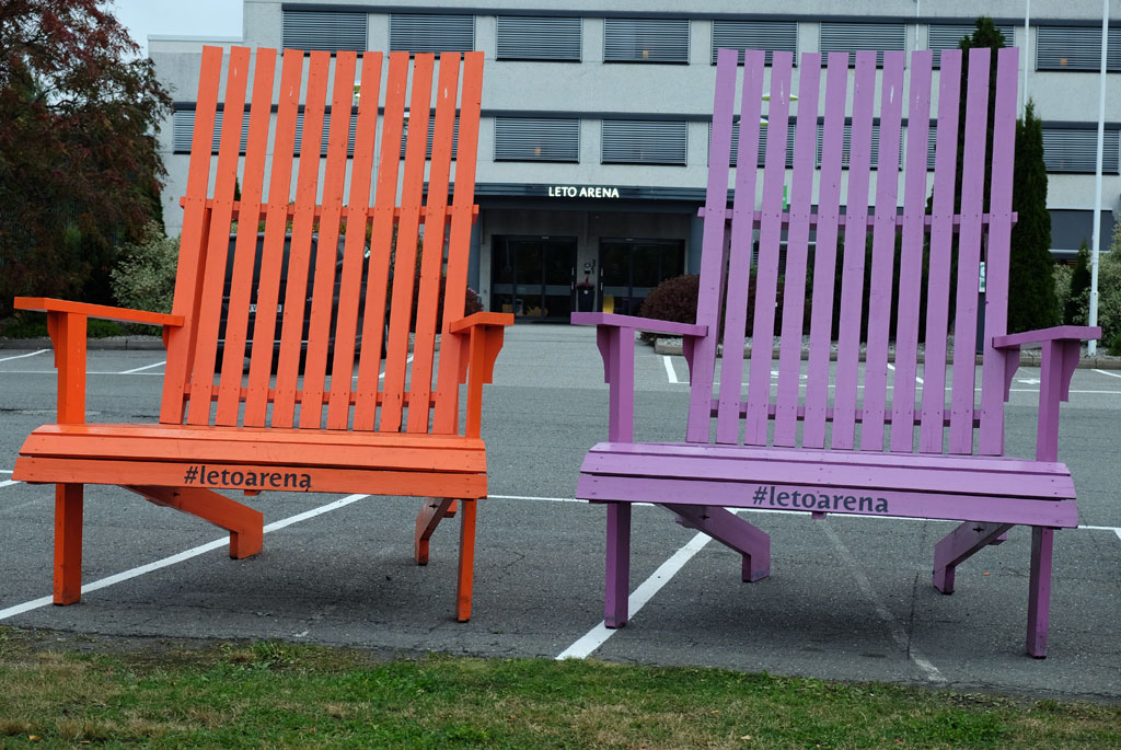
Oversized holiday chairs outside Leto Arena, plenty of space.
Outside the hotel there are some oversized holiday chairs, I take a seat in one of them before I continue the short way down to another corona-closed hostel, Risebru. Here you will also find an old stone vault bridge, dated 1827 (restored in 1994).

Older road signs at Risebru.
From here you can follow the road uninterrupted, but the trail takes you on a small detour. The weather was grey when I stuck my head out the door of the hotel, but here where the path takes one around a small pond, there is a light of hope above me. A short and peaceful little walk around a pond with ducks happily splashing around in, over an ornamented little bridge, in a light that highlights the colours of the background. Afterwards you climb over a stile and are back on the road not very far from where you left it.

After Risebru, the pilgrim path goes around this small pond.
Going in the opposite direction has presented some problems, but going with a guidebook that is not completely up to date also offers some problems. In my version of the guidebook, I will go up to Sessvollmoen, but in the updated version you will not do it, no matter which way you come from.

The pilgrim way no longer goes here, but I ended up going here anyway as I had not the updated guidebook with me. After Sessvollmoen.

An undulating field landscape.
On the other hand, I am dutiful and follow the instructions, even though there are no waymarkers. Here I am doing great and finds the route, which is no longer the route, but there are still some waymarks that remain. I look over at the fenced military area and walk between fields without knowing if I am on the right path. Finally I am back on the same road as before (again).

At Dagsjøvegen.

A slightly dystopian element on the walk.
Being on a road or not, I am now a little in my own world of thought, so the hard surface passes by quite unnoticed. I find the patterns in the undulating acre next to the road fascinating and then that the pilgrim path takes off from the road just past the same acre shortly afterwards.

The eighteen Arhats in Lien Hoa Dao Trang Buddhist Temple (The Lotus Temple).
After a short walk through a forest, I take the wrong path again. Get to see stone crusher machine in a quarry at close range. Not very scenic, but interesting in a way, maybe more than what the actual route is.

Lien Hoa Dao Trang Buddhist Temple (The Lotus Temple).
Trafficked roads and unattractive walking follow. Until memories begin to fill up mind. Suddenly I am back in another time, back to another place. I was not well enough prepared for this probably, I am outside the Lien Hoa Dao Trang Buddhist Temple (Lotus Temple).

Nordbytjernet.
The surrounding landscape is not the same. I do not wear a straw hat on my head, white vest or staff. I am not on Shikoku, but the memories from there are popping up now. I just have to go in and ask if I am allowed to look around. This is a Buddhist temple according to Vietnamese tradition, and thus not quite like the ones I visited at Shikoku. In the area you can see statues of the four great heavenly kings (Tứ Đại Thiên Vương), the eighteen Arhats (Mười Tám La Hán) and not least the bodhisattva Địa Tạng (Kṣitigarbha). The eighteen Arhats in a row remind me of the Gohyaku-Rakan statues in Japan (they are related).
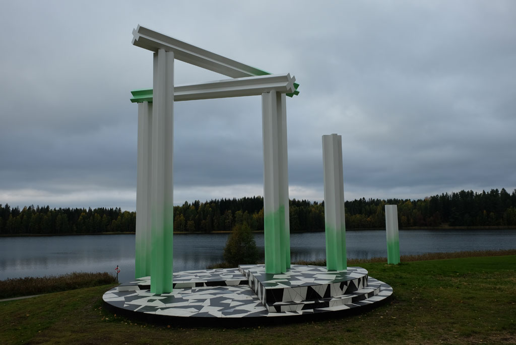
Broken Thrones by Camilla Løw, Nordbytjernet.
With the heart sutra in mind, I continue. Eventually I come to Nordbytjernet, after a somewhat elusive walk there, where it is peaceful. Perhaps even more peaceful than it is during normal times, with less air traffic from Gardermoen right next door. Looking out over the water you will find the Broken Thrones artwork by Camilla Løw, inspired by European 19th century pavilions that meet modern materials.

The sword at Raknehaugen.
The route follows around the water, takes a short walk through a forest and after a bit of walking along a road I come down to Raknehaugen. This is the largest burial mound in Northern Europe, with a height of 15 meters. If you walk around it, you have walked 77 meters (you should not go up on it). The burial mound dates from the migration period between the years 400 and 600. A sword meets me at the foot of the mound, the runic inscription found on the sword (a sculpture and replica, not a real sword) should indicate: ‘This is the king's sword’.

Raknehaugen.
In Jessheim I put the pilgrimage on hold for a short break. Afterwards, I am out in the woods again. It is a pleasant walk over to the place with the somewhat ironic name Høyfjellet (translates to ‘High Mountain’), but it is not further exciting. Between the fields and the farms afterwards there is a nice light.

Herredshuset, Jessheim.
And then my ability to orientate does a short circuit and I turn right instead of left where the pilgrim way comes down to Randbygrenda. Had I continued and then turned left at the next intersection, I would have been able to return to the pilgrim way again at Ullensaker church.

Through the woods towards Høyfjellet.
On the other hand, it would mean that I would have missed Den Wingerske Kongevegen. A cosy stroll alongside fields. In a nice light I walk towards Romeriksdomen which protrudes from the trees in front of me. The real name is Ullensaker church, which is a fairly new church from 1958 and is the fourth church that was built here since the first saw the light of day in the 13th century.

Waymarker on a tree with its shadow.

Here I am heading in the wrong direction at Randbygrenden.
The pilgrim path has passed through a golf course before (Atlungstad), the waymarking through Miklagard, however, is not as good in the opposite direction here. The sole means of visiting Kløfta is to get to the store to buy the last dinner and breakfast for the hike.

Den Wingerske Kongevei.
The darkness begins to descend as I approach Arteid, suddenly the red colour off the waymarker-poles has turned yellow and dazed I take the wrong path (why have it changed colour to yellow here?). At Arteid Vestre, a loft has been turned into a place for the pilgrims, that is at least red.

Ullensaker church.
Inside the loft, on the second floor, the pilgrims have got their pleasant little cave. There is even a massage chair here, and an antique-looking oven that can still be used. Should there be anything to complain about, it is that the shower and toilet are located some distance away in the yard (in retrospect, this should now have been improved).

Walking on Den Wingerske Kongevei.
The evening comes and dinner is prepared. And what matters most now is to relax for the very last day of the pilgrimage. Which also will be the longest day of them all. When the night has arrived tomorrow I will be at home in my own home, that feels weirder now than on my other long walks. Then I have always had a journey home where the feet have not been the primary means of travel.

The pilgrim hostel at Arteid Vestre.
Relaxing here inside the pilgrim hostel at Arteid is no problem. Outside, a light drizzle has begun.

Inside the loft for pilgrims at Arteid.
<< Dal // day 28Sagene // day 30 >>


No comments:
Post a Comment