Distance: 37.5km (746.4km).
No rain in the morning as reported, but it is slightly chilly outside. On the way back to my own home, I had wanted to spend two days going to Hamar. To make the two days roughly equal in length, the choice fell on Rudshøgda as the destination of today. It is about 60km from Brøttum to Hamar and Domkirkeodden, from here to Rudshøgda it is a little over 30km to walk.
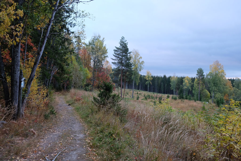
Autumn colours in the trees on the culture path after my camp site.
Beyond that, Rudshøgda is not a very attractive place to go to for pilgrims, not much more than a noisy intersection on the E6 with a roadside inn, shop and petrol station as facilities.
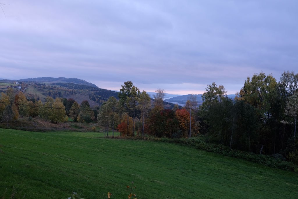
View from Brøttum and the culture path.
Even if it does not rain, I throw all my gear into the shelter while I am packing down my tent, shelters are fine in case of rain. The culture path continues to the centre of Brøttum. If you walk a little away from the path towards the end (in the beginning if you go in the direction of Nidaros), you will find some places that gives a good view of Mjøsa. Far down in the south I can see a bright line in the horizon, it will not come as a surprise if it starts to rain during the day.

Autumn colours and picket fence on Brøttum culture path.
Brøttum church has an atmospheric background and two green trees on one side, while on the other side there is a green tree where orange flames begin to spread on.
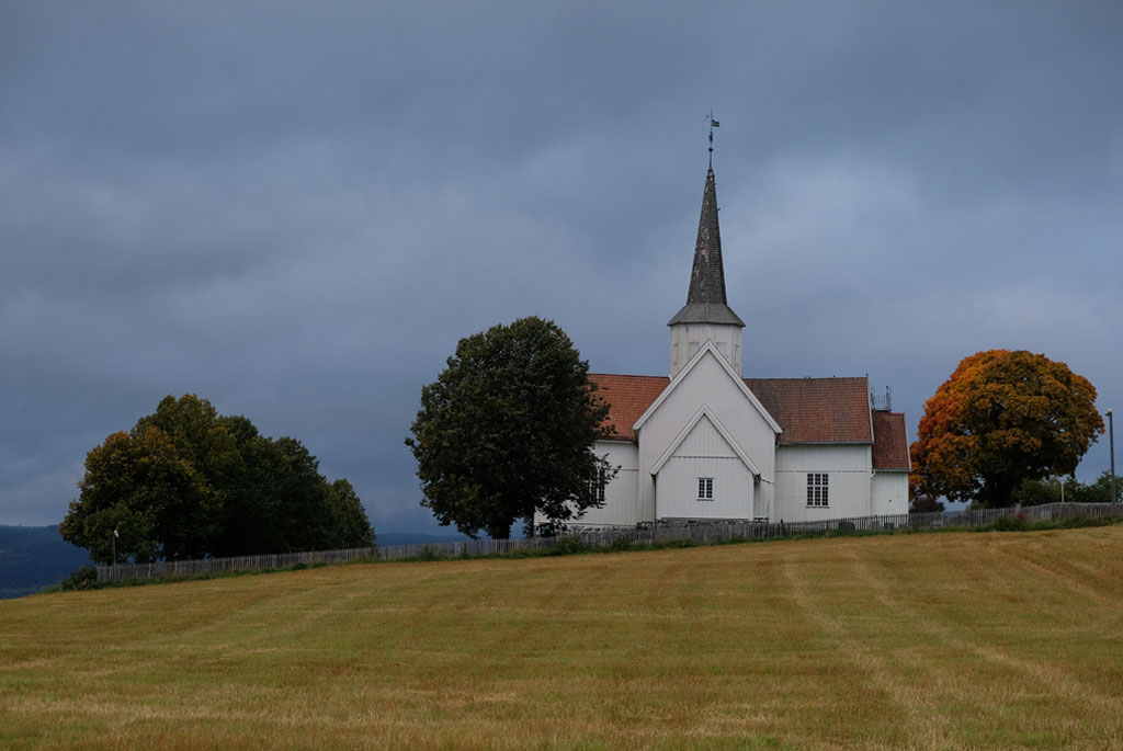
Brøttum church.
The pilgrim path takes to the heights, on a road, but the hard surface is quickly forgotten. Below is Mjøsa, on the other side I look towards Biristrand and over the landscape is a grey but not dead sky. The view comes and goes, but when it appears it is nice. The dark clouds give the landscape a more gripping feel. Above Kløvstadhøgda nature reserve (protected due to deposits of noble deciduous forest) you get the best view on the road you walk on. The mood in the sky may not be so good, but mine is.

Ascent on a road with a view of Mjøsa.
The route pulls inwards, away from the shores of Mjøsa, and takes you onto a path again. The path feels messy and gradually it becomes even more messy due to logging. Coming in the opposite direction, it was also at one point difficult to see where the pilgrim path was going. At the same time, the weather felt a little extra sad on the same stretch.

View over Mjøsa, rain and light in the horizon.
After a good distance on the way down, I come to Smedstadsletta, here you will find Tolvsteinringen ('The Twelve Stones Ring'). As the name suggests, these are twelve stones, erected 2000-2500 years ago. If you count meters between the stones, you reach 6 meters. From one stone to the other on the other side of the circle you count 25 meters. The first raindrops of the day arrive at the same time as me to the stones.

At the top above Kløvstadhøgda nature reserve right by the pilgrim path, there is a good place to look out over Mjøsa.
The centre of Moelv itself is not right on the pilgrim path, but the urge for coffee makes me stop by. The route, on the other hand, goes in a nice arc outside, through a pleasant forest with Mjøsa right next door. Through the forest it is a little difficult to follow the pilgrim path straight, but where I went the wrong way, it led me out on something I think is an even nicer walk. I come out to Boligvika, where I can see and hear the water of Mjøsa hit the beach before I must admit that the trail does not go here.

Tolvsteinringen ('The Twelve Stones Ring') outside Moelv.
No Skibladner is outside the pier, but there are flowers on the pier anyway. A quiet and peaceful campsite (Steinvik) is passed. Enough time to have lunch at a picnic area next to the water before raindrops can be felt again.

Pier for Skibladner.
The rain does not last long and is of very low intensity. At Ringsaker church, dark clouds dance along with sunlight breaking through them. Maintenance is carried out on the church, which dates from the middle of the 12th century and is among the best-preserved medieval churches in Norway. The Pilegrimsstuggua pilgrim hostel is closed this year.

The pilgrim path goes on paths through forests right next to Mjøsa around Moelv.

Back to walking on the shores of Mjøsa, this time on the east side.
The advertised fighter jet that I should be able to see along the trail according to the guidebook is no longer there, but I have to give my kudos to those who leave the old gas station in the same place.

Pause at the shores of Mjøsa.
Going in the opposite direction today would present several problems for me, but the first wrong turn after Ringsaker church I probably have to my blame myself for. Although the arrow that marked where I should take off from the road was not very big, I should have seen it, but it makes me get to look at a new pilgrim hostel. Husmannsplassen Hesthagen, which at first and incomplete glance looks ok.

Rain clouds over Mjøsa and Ringsaker.
I make another mistake again not long after. Not sure if it is the right way, I take a path, as according to the guidebook I will get out on the gravel road I walk on from a path if I go in the right direction, but it is too early. The right path takes me onto Præstvegen ('the Priest Road'), which I will follow almost all the way to Veldre church, if I can find it.

Ringsaker church.
I do not, after a pleasant walk through birch forest and autumn colours, I eventually come out along a field (past Ulvstuggua whatever that is) and a new junction. No waymarks to see, so there is a fifty percent chance of taking the right path. After a while it becomes clear that I chose the wrong fifty percent, back at the intersection I meet a local hiker who confirms that it was the second choice that is the right way. Well hidden in the bushes, I find the sign that would have made everything easier.

Ringsaker gas & service.
It starts to rain, first lightly, then it slowly increases in intensity. I have nice company the last bit to Prøysenstua (the former home of a Norwegian folk songs singer and writer, Alf Prøysen). In the silence you can hear someone singing 'når nettene blir lange og kulda setter inn' ('when the nights get long and the cold sets in') from the forest. The new Prøysen House is closed, in the background Prøysenstjerna rises, and I bring out my childhood in Mikkelikskiskogen.

Wavy acres and a farm on the way to Rudshøgda.
Rudshøgda is in every way perhaps one of the least charming places you get to along the pilgrim path. The whole place is really nothing more than a big junction, with the busy E6 thundering through. On the other hand, it is not the fault of the employees at 'Frich`s Motell og Spiseri Rudshøgda', because they are nice. At the same time, the setting is just so weird that it actually makes my whole stay at the place pretty good.

Autumn colours on the Præstvegen.
In the evening rain, I walk back across the bridge to shop at the Obs store. Maintenance is carried out at the intersection, so that all traffic is redirected over the driveways. If you eat at a roadside inn, you eat at an inn. I go all in and order biffsnadder (steak snacks being the closest translation), with a cold beer.

Prøysenstua and Prøysenstjerna.
It has got dark outside, the rain has increased in intensity and there is a full stop in the traffic. People get in and out of the cars impatiently, trudging back and forth, small clouds of smoke rising here and there. The reason? Maintenance is complete, but it takes time to reopen the road.

Rudshøgda.
When the inn closes, I return to my room. Outside, the truck drivers help each other back the trucks into place. At the store I bought some snacks for the evening and while I relax in bed I think back on the day. It has been great. Dramatic and nice view, varied, with my mistakes in finding the way being the only negative thing. It just makes this day extra eventful.

Dinner at Rudshøgda, had to be steak snack.
<< Brøttum // day 23Domkirkoddenn // day 25 >>


No comments:
Post a Comment