Thursday, August 29, 2019

Der Traumpfad // day 10 // Wattentaler Lizum - Tuxer Joch

Der Traumpfad, day 10.
Distance: 10.8km (214.6km), time spent: 6:21.
Weather: Overcast, some rain and fog in the afternoon.


I wake up to a stage on Der Traumpfad that is not so long in terms of distance, only 10km, but should more than make up for it in terms of necessary climbing given by the description of the route. The plan is to walk to the Tuxer Joch Haus, but that hut is famous for its policy of demanding a deposit when booking, which rules out that option for me. I have no means to make a deposit now and has to rely on a bed being available when I show up (and in truth, I do not like to book ahead either). A shorter day might also be a good option when the weather for the day are uncertain, the forecast is for a thunderstorm.

Information board outside Lizumer Hütte displaying which areas where a military exercise will be held today, all but one area has a flashing red light, my path goes straight through one, but the path is not blinking. I should be fine.

Old military paraphernalia, an old cannon stands rusting below Kalkwandspitze.

Lunch is included with the breakfast at the Lizumer Hütte, the bread is of the same heavy sort from before, but that is a small price to pay for such a great hospitality. Looking up at the sky after leaving the cabin, reveals a lot lighter sky than the forecast suggests, patches of blue are interspersed between the clouds. Outside the hut there is a signpost with a map of the surrounding areas. Red led lights indicates which of the areas that there will be conducted a military exercise in. The area I will be walking goes straight through one of these red blinking areas (actually all but one area are flashing red), but I have been assured that the exercise will not start until I should be well outside of the area.
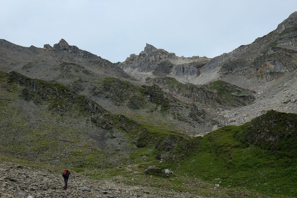
Martina at the start of the steep ascent to the Geierjoch pass.

The trail is following the bottom of the valley, before it will start the climb up to the Geierjoch. Towering above me on each side are the summits of Tarntaler Köpfe (2757m), Lizumer Reckner (2886m), Naviser Reckner (2824m), Kalkwand (2826m), Junsjoch (2484m) and Pluderling (2778m), rising up from a mix of green and grey scenery. Next to the path are old military relics, a rusty cannon stands ominously pointing its turret towards the hikers passing by.

View down the Wattental and towards the Lizumer Hütte.

Army chopper doing a reconnaissance of some sort of the area, probably as a part of a military exercise or preparation for one.

Josef had as expected started earlier than me. He opts out of the breakfasts at the cabins and instead insist on walking out earlier to find a place to prepare his own breakfast. An idea that resonates heavily by me, but as I had decided not to bring my tent, I had also not brought with me my cooking equipment. I find him sitting a little bit above the path, enjoying a peaceful morning surrounded by mountains. This would be his last day on the trail.

Junssee from Geierjoch, with Gefrorene-Wand-Spitzen and Olperer at the back.

Ascending, the scenery gets rocky and grey. A path comes in from the left and I become certain that I have taken the wrong route from the hut, but there really is not much that separates the route I had taken and the sort of proper route. Only the surface to walk on, I surmise, the views would be the same. If you follow in my steps on this trail, see that you find the actual route that follows a footpath after Lizumer Hütte and not the gravel track.

Josef sitting at the small stool at the top of Geier.

At the summit of Geier with the vulture statue.

Climbing is steady up towards the Geierjoch pass. Since I left the hut, the sky has become more grey and less blue, as the ground has become more grey and less green. A small shelter of some kind is visible above to my right, but I believe it to be some kind of a military installation. Then loud whirring noises are heard, echoing closer to my location. And then a military chopper comes flying close over my head, taking turns to cross over the pass up front of me. It does several rounds in the valley, hovering close over the small shelter I had seen at some time, confirming my suspicion. I only regret not being higher up when the helicopter flew low over the Geierjoch pass, which would make for a great picture. Eventually the sounds recedes.

Descent from Geierjoch, Junssee below.

The views back down the Wattental valley had been wonderful all the climb up, but it comes short of the view on the other side of the Geierjoch pass (at 2743m). Reflecting the sky lies the Junssee below like a huge eye in the ground, which is a glacial bowl all clad in grey. Behind lies the Gschützspizsattel with the dominating peaks of the Gefrorene-Wand-Spitzen and Olperer towering behind that again. Der Traumpfad can be seen like a clear line winding itself towards the Gschützspizsattel pass, through grey background at first, then green, before back through a grey background. I had forgotten to brush my teeth at the Lizumer Hütte in the morning, this spot offers a far better view while doing that.

Ants....Josef, Michael and Sophia descending from Geierjoch.

Above the pass lies the summit of Geier (2857m), the climb up is relatively easy, but rewarding. Geier translates to vulture and accordingly there is a metal vulture statue at the summit. Wonderfully quirky there is also a small stool at the top too, if a break is needed. Josef arrives a little bit later, just as I was about to go down again. He had wanted to climb the nearby Naviser Reckner too, and I had been toying with the same idea, but we both discards the idea as it turns out. Our paths diverge after here, from the Junssee lake below, he will go down to Hintertux and then Mayrhofen.

Narrow ridgewalk between Geierjoch and Gschützspizsattel.

A view back towards Geier, another interesting descent in terms of how it looks afterwards.

From Geierjoch, the trail heads down towards Junssee (but not all the way down to the lake) on a faint path between loose stones, fairly steep in some parts. In fog, some has warned against taking this route. I go down to the lake, watching Josef and some others descending through the scree from below, they look like tiny ants in a huge field of stones.

The rocky ascent to the Gschützspizsattel pass.

After Junssee, the trail goes first at the top of a minor ridge with steep views down the valley below. Leaving the ridge, the path goes steadily down with the wall of the Geier becoming progressively more massive. Dieter and Karin are slowly negotiating their way across the landscape and steep sections on the way. Clouds are starting to roll in over the Geierjoch. Up to the Gschützspizsattel (2657m) the path is back to an increasingly steeper and stonier surface. The sight from the pass are magnificent, offering the best views of the beforementioned massif of Gefrorene-Wand-Spitzen, Olperer and Hintertux Glacier so far, but the peaks are now having trouble getting clear of the clouds. This is the spot for lunch, no doubt.

View from the Gschützspizsattel pass, Gefrorene-Wand-Spitzen and Olperer besieged by clouds.

Also revealed at the pass, is the steep path I have to descent. The bottom seems so far away all down there. At first going just below the summit of Wandspitze (2614m), then in zig-zags down the mountainside, but on a good path and surface to walk on. Tiny dots moving upwards and tiny dots moving downwards. Marmots are sounding their warning sounds, and I see some scurrying away from the path.

Winding descent from Gschützspizsattel with a mighty backdrop.

I had briefly talked to Michael and Sophia earlier, they had stayed at both the Glungezer and Lizumer huts and at the bottom of the Weitental after having climbed all the way down, I get to talk to them more properly. We walk the rest of the way to the Tuxer Joch Haus together and I enjoy their company. Rain is hitting us on the final approach to the cabin. Tuxer Joch Haus looks like a partially old building, with a modern winter garden in front of it. Thankfully, I have no problem getting a bed for myself.

Path with views of the towering Zillertal Alps.

Michael and Sophia descending.

As the rain settles in, it feels good to sit underneath the glass roof of the winter garden overlooking the dominance of the Zillertal Alps across the valley (despite carrying the name Hintertux Glacier, it is in the Zillertal). The others I met earlier are now at least one day ahead of me, maybe even two. I spend the evening together with Martina, Lucas, Michael, Sophia and Enrique.

A waterfall seen at the bottom after the climb, marked as Wssfall on my map (?).

In Weitental, looking back at the winding descent that we came down upon.

During the afternoon and evening, clouds drifts in from the valley below. I would have expected it to come from above, but the onslaught is rising up from below, engulfing the cabin in fog. At one point there is nothing but whiteness to see outside the windows. I frequently takes walks outside. For dinner I have dessert, kaiserschmarrn, which I call a pancake, to which Sophia greatly objects against.

Tuxer Joch Haus in the afternoon, clouds rising up from the depths.

Another wonderful hike today, maybe even better than yesterday, with Junssee the big culprit in making the difference. Only drawback was that it was kind of short, I probably could have reached the next shelter on the trail, Friesenberghaus (and maybe even the Olpererhütte), but that would have meant negotiating the Friesenbergscharte in rain and fog. Now I am here at the Tuxer Joch Haus, but the evening was nice with good company, so who am I to complain. Olpererhütte tomorrow, their website says there are no beds available, but that is a problem then, not now.

Good company at Tuxer Joch Haus, Sophia, Michael, Martina, Lucas, me and Enrique.

<< Wattentaler Lizum // day 9Riepenkar // day 11 >>

Wednesday, August 28, 2019

Der Traumpfad // day 9 // Glungezer - Wattentaler Lizum

Der Traumpfad, day 9.
Distance: 16.8km (203.08km), time spent: 10:04.
Weather: A thin veil on the sky.


Does waking up in the morning with a wish to do something, but feeling unable to muster the energy to do so, seem familiar to you? That is how I felt when I woke up this morning, last night I went to sleep with a dream of going up to the summit of the Glungezer in the morning to watch the sunrise. Waking up, my eyelids felt heavy, discarding the idea. What a wonder it is then when I can walk right out the door of the space capsule and straight into the sunset outside. The sky is coloured purple, red, pink, vermilion, yellow and more, just burning, filling me with energy. So much that it draws me away from the cabin and into its fiery embrace. Despite being a marvellous sunrise, the sky is not clear, but I do not think it will lessen the experience of the walk today any.

Sunrise from the Glungezer Hütte.

Fiery sunrise.

It was chilly in the space capsule during the night, although it did not maintain the temperature in space of course. It made for a good night of sleep. Described as a seemingly endless series of peaks, Der Traumpfad from the Glungezer Hütte takes the hikers across what is known as the 7 Tuxer Summits 7 Gipfel Tour. The seven summits are Glungezer (2677m), Gamslahnerspitze (2640m), Kreuzspitze (2746m), Rosenjoch (2796m), Grünbergspitze (2790m), Grafmartspitze (2720m) and Naviser Sonnenspitze (2619m). The route never stays below 2000m. Not necessary to mention, but I am excited about the prospect of hiking today. As it turned out, it was to become a day consisting of just as many ups and downs in feelings as it was on the route itself.

Glungezer gipfelkreuz.

The Glungezer I can easily check out of the list, accessed by a short hike up from the cabin. I walked up to the summit yesterday as well, taking a sneak peek at the terrain I would be walking over today. Rough and barren terrain, an undulating rocky ridge with the promise of slow walking, but most all of promises of a great hike with equally great views. All the way in the back, the massif of the Olperer and the Gefrorene-Wand-Spitzen. At my back the Karwendel Alps are silently saying goodbye to me.

The Hintertux massif, Gefrorene-Wand-Spitzen, Olperer and the Hintertux Glacier.

The seven Tuxer summits ridgeline.

Navigating today should be fairly easy, with red-white-red blazes to follow, but in bad weather it would be a different matter. The path is everything from a smooth line clearly visible ahead and good to walk on, to rocky, uneven and sometimes obscure. I quickly catch up with Lucas, who started out earlier than me, and we walk fairly together from then on. Ahead of us on the ridgeline, we can see a few other moving dots.

Lucas at Kreuzspitze with its destroyed summit cross.

Although the sky is carrying a thin veil across its face, the views are marvelous, consisting of a patchwork of peaks everywhere in the horizon. Deep valleys fill the sides of the ridge. The going is slow at times, due to the terrain, but progress is still steady. Some of the summits are shy and inconspicuous, bearing no marks of being a summit, other than standing taller than its surroundings. Most of the summits do feature the usual gipfelkreuz (summit cross) though and some crosses are found at a pass. The reasoning for when putting up a cross, or not, on a summit or pass I do not know. The next summit after Glungezer, Gamslahnerspitze, carries nothing denoting you are on its top.

At Rosenjoch, the highest point of today, the Karwendel Alps all in the background.

At the top of Kreuzspitze, we find the summit cross lying broken on the ground, destroyed by lightning during a heavy thunderstorm. Rosenjoch is the highest summit of the traverse, at 2796m, both the ascent and descent feature fixed cables. If there is anything negative to be found about this hike, it might be that the constant climbs up and down through the grey and rocky scenery could be a tad monotonous in the end, but there really is not anything negative about it all.

View west from the ridge.

The path and the Hintertux massif.

Not on Der Traumpfad, but hiking on the ridge is also a Dane on the lookout for geocaches. According to him, there are about 140 of them hidden around on the ridge. From time to time, I can see him bending down and search under a rock to find a hidden cache.

Sunlight through the Grünbergspitze gipfelkreuz.

After passing over the Grünbergspitze and Grafmartspitze, stopping for lunch at the former summit, the trail descends down to the grassy pass of Naviser Jöchl (2479m). Good to see some green colors after a long hike in grey. Closer now is the bulk of the Hintertux Glacier, Olperer and Gefrorene-Wand-Spitzen, in a couple of days I will be hiking behind those peaks. Rising up from below, are the green mountain valley of Navistal. Lucas is at the pass, having continued further when I stopped for my lunch break.

Descent towards Grafmartspitze.

Situated above Naviser Jöchl is Naviser Sonnenspitze, its cross visible from the pass. The summit is not on the trail, but will be on my path, climbing up is fairly easy. That is, if you only climb up to one of the two crosses at the top of the peak. The actual summit of the peak is at the top of a precarious cliff, accessible by a technical climb aided by ropes. Not long ago, a woman had died while trying to climb it, losing her grip and had fallen down. Unusual for me, I leave that scrambling alone and goes up to the more accessible cross above. From where the views of the ridgeline that I have crossed over are fantastic. I can see people walking high up there.

Looking down at the valley below from the ridge.

Icon at Naviser Jöchl.

The next section is an interesting one. Here Der Traumpfad goes through a military firing range and it is advised to check out when there will be military exercises here beforehand. I had done so and there should not be any until a two days’ time. Quite contrary to the info, there is an exercise going on. Sharp and loud noises from firing are heard and two army personnel are greeting us at the edge of the firing range. We can go no further and have to wait for the exercise to be over, the time estimate unknown. Quickly the crowd of hikers increases as more and more appear, coming down from Naviser Jöchl.

Naviser Sonnenspitze above Der Traumpfad.

This is the first time I experience anything like this on a hike. In the end, I had to wait for about two hours before being allowed to continue walking. Thankfully, Josef is there too and is brewing up some coffee for us while we wait. Somehow, Martina and Lucas had been able to keep on walking. We could not ask for better views though, while being in a waiting line. From time to time, loud bursts of guns firing are heard, occasionally we can see people moving around in the terrain and army vehicles drive on the road ahead.

View from Naviser Sonnenspitze.

When we finally are allowed to move on, I am eager to get moving again. Yellow signposts warns about that you are entering a dangerous restricted military area. The path and terrain are more gentle here than over the ridge, moving across a grassy and slowly undulating landscape. Below us we can see the army gathering its troops. The trail kicks me out onto a military gravel road, which it will follow almost all the way to the Lizumer Hütte.

Waiting on the army...

Walking through the military firing range.

Walking on gravel tracks is not always what hikers enjoys the most, but think of it. It is far better to walk on the worst part of the scenery and look out from it, than walking outside of it and looking at it. The scenery around is great. I pass by military posts, several summits, a small lake (Klammsee). The trail only leaves the road for a shortcut where the military road goes in long and winding turns. At a time, a small procession of army vehicles pounders by, dust in its wake. On the final descent towards the cabin, the trail finally leaves the road.

Navisertal.

Lucas and Martina greets me at the hut. They had been lucky and had got permission to cross the military firing during a longer break, on the terms of no dilly-dallying on the way. Appearing without a booking makes the people working at the hut raise their eyebrows, but they manage to find a bed for me. I share a room with three others who are going in the opposite direction, they will go to the Glungezer Hütte tomorrow.

Klamsee and the military road besides it.

I should think that the problems I had with the army was over when I left the military firing range, but it is not. Standing at the bar to get a beer, I notice a large group of people coming up from the army camp below. To which I get the following respons, 'Oh shit, they are early today'. Apparently the soldiers are going to the hut for food and beers after the exercise of the day is finished. Eventually this leads to the fact that I (and other guests) have to wait even longer for my dinner. Quite ironic in a way. Not only did we have to wait for a long time to get hiking, but we also had to wait for a long time to get any food. And not only did they make a lot of noise at the range, they make a lot of noise here too. So much that I escape out to get some peace and quiet, only for them to follow shortly after. I share a table with Dieter and Karin, a couple also doing Der Traumpfad, they had walked up from Wattens.

Wattentaler Lizum below.

For all the great walking of today, the evening was a little bit of a downer, although there is not much to do about it other than to laugh. A superb ridgewalking is too good to discard due to this. Tomorrow will be another exciting day, in both scenery and also in the terms of it being possible to walk. The weather forecast is uncertain, warning lights are flashing for a thunderstorm, possible from the morning on. Eventually everything calms down at the hut and some peace and quiet are restored.

The Lizumer Hütte.

<< Glungezer // day 8Tuxer Joch // day 10 >>

Tuesday, August 27, 2019

Der Traumpfad // day 8 // Hall in Tirol - Glungezer

Der Traumpfad, day 8.
Distance: 23.1km (187.9km), time spent: 8:21.
Weather: Great.


Causality, cause and effect. By deciding to only go to Hall in Tirol yesterday, I have to face the whole of the long slog up to the Glungezer Hütte today, which implies a total gain of 2400 altitude metres. If the climb is too long, I have the weather to aid me, it appears to be a beautiful day. Der Traumpfad is from Hall moving up and into the Tux Alps, keeping relatively high up for several days. In very bad weather, it is advised to bypass the Glungezer Hütte and go directly to the Lizumer Hütte from Wattens instead. Wattens is found a little bit more to the East of Hall in Tirol.

Hall in Tirol and the Karwendel.

I had a warm night, as the air-condition in my room was failing. When I talked to the manager about it in the morning, he apologized, but was surprised that I find it hot. According to him it was cold, but then, I am from Norway. At least the breakfast should give me enough energy for the climb up. Then I pick up my humble belongings and goes out to try to find the way out of Hall.

Sunlit path out of Hall.

Tirol landscape.

Looking at the map, the markings of all the connected paths appear like a spiderweb, it is quite the navigational task to find the correct threads to follow through the web. However, Der Traumpfad does not follow a single set of waymarks and in that line of thought, I believe that it is room for personal choices in regards of which path to take. Meaning, if you know which place you need to go to, it does not matter much which way you choose to get there. A good example of the term you make your own path, or way, so to say. I like that, even as a purist, but I will still try to do what is the official route. It must be said, though, that if you do not have any description or guide of the route, you are unlikely to be able to follow the route properly.

A religious icon next to the path.

Actually, finding the way out of Hall was not tricky, but it is making all the correct turnoffs afterwards that is tricky. As expected, the walk alternates between being pleasant and uninteresting. And with no waymarkers to follow, I do at times wonder if I am taking the right course. Places and signs some times differ from what I read in the description of the route. One reason why the trail do all these twists and turns, I believe is because they have tried to make the route go as much as it can through wood- and farmland paths as possible, at times taking an unexpected direction. On the final approach to Tulfes, the path is lined with religious icons, like a way of the cross, each icon depicting a scene from Jesus' walk to the cross.

Great view of the Karwendel Alps from the Gästhof Windegg, Hall in Tirol below.

The small chapel at Gästhof Windegg.

Tulfes is not as bad as expected, but not interesting either. Last place to buy any provisions if needed until you reach Niedervintl, some six to seven days away. After a break, I look at the people boarding the cable car and then I set forth on the road leaving Tulfes. Although on a paved road, this is an improvement, I have already gained some height, so there are views from the road. Rising more clearly on the other side of the Inntal valley is the Karwendel.

Road above Windegg, the Glungezer directly overhead.

Having walked about two and a half hours since I left Hall, I reach the Gästhof Windegg, which is maybe the best option to go to if you want to go further than Hall, but not all the way to Glungezer Hütte. The views are great from the guesthouse and the small chapel next to it. For all the talk of being a mountain trek, this trail is passing by so many religious items that you will not be far off if you call it a mountain pilgrimage.

An icon inside a chapel at Tulfein Alm.

The next haul is somewhat less interesting again, as the trail heads into the forested belt between the Gästhof Windegg and Tulfein Alm. This is the part where the path intermingles at most with all the items you find in a ski resort. And the surface is a mix of paved and gravel roads. Large trucks are pounding by on the roads at the beginning, at great speed, sending up large clouds of dust as they pass by. There appear to be a path that goes inside the forest, rather than on the roads, if I had known, I would have taken that route instead.

At Tulfeinjöchl.

Nibelungia Hall, a cross above the Tulfeinjöchl.

Arriving at Tulfein Alm is thus a little bit of a relief. Both in regards of the views of the past and future alps. Some part of me is thinking that this would have been a better experience had the weather been worse, believe it or not. Alright, I would have missed out on the views of the Karwendel Alps, but the hike up would have been more mysterious and atmospheric, especially if it was foggy. I think the main problem today is that it takes too much time to get to the exciting part of the walk. Which really is still somewhat above Tulfein Alm, and also close to the end at Glungezer. The paraphernalia is still scattered around and what appear to be the construction of a dam.

Looking up at the mighty ridgeline I will walk over tomorrow, the Olperer in the background.

Climbing higher it all become history and so better. Another summit with a cross on top stands overlooking the line of mountains above the valley below. Things are getting more barren only when the trail is making its final approach to the hütte. The jagged line of the seven summits that I will walk over tomorrow lies daunting ahead. Bare bones of rocks and stones.

The path climbing up above Tulfeinjöchl.

Ascent of Glungezer.

Tucked in between the Glungezer and the Sonnenspitze, I find the Glungezer Hütte (2610m). A small stone cabin with a nice terrace and a weird metallic structure outside. Which is where I will sleep in, it looks like a space capsule or pod, of a kind. Quite cool. The young people working at the hut are playing football at a small wooden platform next to the hut, occasionally kicking the ball over the railings and down into the bouldery basin below.

Glungezer Hütte.

View of the Inntal valley from the Sonnenspitze.

Lucas and Martina is at the hut. The others are now one day ahead of me, I envy them the walk they must have had today over the undulating high ridgeline to the Lizumer Hütte, it must have been great in this fantastic weather. Lucas had taken a wrong turn on the way up, which had led him to what appeared to be far nicer route up, although a little uncertain in terms of getting to the right place.

Glungezer, gipfelkreuz and the Karwendel.

Above the cabin stands the summit of Glungezer, at 2678m. Adorning the summit is a supply-lift, various communication equipment and the gipfelkreuz. Nearby is also the summit of Sonnenspitze, at 2639m, with only a gipfelkreuz at its top. At the top, I meet a German girl who is walking the Inntaler Höhenweg with a friend, the trails cross paths at the Glungezer Hütte.

A hiker sheep.

At sunset after dinner, the manager of the hut is gathering all the guests at the summit of Sonnenspitze. The next day over the seven Tuxer summits is a hard one and should be avoided in foul weather they say. At the summit, with great views in the waning lights, he gives us the weather forecast for the next day and a brief about the hike to the Lizumer Hütte we face tomorrow. It is both informative and social. Thankfully the forecast is good, although not as good as today.

Sonnenspitze at sunset.

In the evening, I meet Josef, as Lucas only doing part of the way. It is a good place to stay at. A partly boring and partly pleasant walk, thankfully with great views on the way up, but it all works more as a transport stage for the next day on Der Traumpfad, a walk proclaimed to be one of the best stages of all of the trail.

My home for the night, the space capsule.

<< Hall in Tirol // day 7Wattentaler Lizum // day 9 >>

popular posts