Tuesday, July 13, 2021

De Kvite Kyrkjene // day 2 // Bråtådokktjønn - Buverudåsen

De Kvite Kyrkjene pilgrim path, day 2.
Distance: 42.7km (70.0km).


The next church after Hovin is at Austbygde, some 30km between them. I have already eaten up some of those kilometres, so less to go. The day will however not be finished at Austbygde church, so more to go still. From Austbygde, the proposed route has been altered, a note at Hovin church told me that it was impossible to go down from the road the pilgrim way was going on to the church. This means that the walk up to Austbygde church from Austbygde will be a round trip.

Bråtådokktjønn in the morning.

That is still some hours away from when I wake up in my tent to a quiet lake in the morning. Even the annoying hoard of mosquitos and gnats from yesterday evening is quiet as I prepare my breakfast and morning coffee.

The path over Ramnskardåsen.

This part of the pilgrim path is following what is called Gamle Hovinvegen, an old way that now goes past pines, rocky outcrops, and bogs on its course over Ramnskardåsen. The walk is scenic and pleasant, a fine start to the walk of today.

More creek than path, this wet section was just before getting to the Sønstevatn lake.

When walking a trail that you at first hand was a little bit sceptic of, there is nothing better than to find out that you actually are enjoying yourself when you are walking it.

De Kvite Kyrkjene pilgrim path going past Bjortjønn.

Bjortjønn lake.

Coming down from the Ramnskardåsen hill, I find myself walking through an area with some scattered cabins around. The walk has changed from going on a foot path to a forest track as it passes by a string of lakes, Sønstevatn, Heivatn, Bjortjønn and Tovstjønn. Relaxing views for the eyes.

Tovstjønn with its tiny island.

Gamle Heie Skule is an old school the pilgrim path passes by, which stood ready for use in 1886. It provided education of the kids in the surrounding area until 1958 when it closed. For some the walk to the school was both long and steep. It is now being used as a school museum. Looking through the windows, I can see the old furniture from the time it was in use, musing on how different the education probably was in comparison to my own.

Telemark farms.

The old school house at Gamle Heie Skule.

This part of the pilgrim path follows gravel tracks, forest roads and some few paths in between. The path crosses over a creek called Lengstebekk (which translates to ‘The Longest Creek’). A short walk on a paved road (the same road we used to get to my starting point yesterday) has to be tolerated to get to the final section of the walk before reaching Austbygde. Fortunately, that section is a very pleasant one (not the walk on the paved road of course).

Lomtjønn.

Leaving the road, there is a short walk on a gravel track past the Hafoss lake with its cabins. Then crossing over a bog on what appear to be a makeshift boardwalk, and a nicely situated bench with a table in the middle of the bog, it is all forest paths. Midttjønn lake are visible through the trees, while the much larger Gjuvsjå is not.

Hafoss lake.

This is still the old Gamle Hovinvegen way. It is a lovely forest scenery. Sometimes, old and forsaken farms are visible next to the path. Three old bridges are used to cross over running water.

Crossing over a bog after Hafoss, passing by a picnic bench and table in the middle of it.

Gamle Hovinvegen old way.

Before the descent to Austbygde, a small detour takes me up to a hill called Verpenuten with a great view over Tinnsjøen. The detour is marked with a sign ('Utsikt'). Taking the short part on the paved road out of the equation, the walk so far today has been enjoyable. This is a nice addition to it.

A barn or a farm that appears to be no longer in use.

I have been walking a little over 5 hours when I arrive at Austbygde. This village provides the most in terms of services on the pilgrim path. For pilgrims or hikers, it is the food store and the local bakery that will be the primary targets. I stock up on some few supplies and food, then have my lunch at one of the picnic benches. Needed some drinks too, it has been a warm day. Before I continue, I grap a cup of coffee from the bakery.

The pilgrim path passes by these stones that appear to be some kind of old waymarks.

From Austbygde, the pilgrim path has been altered, as I had been given warnings of. Instead of going higher up on the road towards Veggli and then down to Austbygde church from there, you have to go up to the church and back again from the village centre. Normally, the pilgrim path stays higher up, not going down to the village, but people might have to go down anyway, if they are to find accommodation in Austbygde.

Great view over Tinnsjø from Verpenuten.

Going up and back the same way usually does not appeal to me, so I scour the map for possible other ways to go. I do find some options, but in the end, I decide to just follow the same way. It is not an unpleasant walk.

Alt blir bra ('Everything will be fine'), at Austbygde centre.

Before the church in Austbygde was consecrated in 1888, the people living here and in the Tessungdalen valley had to walk to Atrå to get to a church. Where there had been a church since around 1180.

Austbygde church.

On the path between Austbygde and Austbygde church.

If trying to figure out distances walked, the guidebook to the pilgrim path is a little bit confusing around here. As the book describes the walk in three chapters, a roundtrip from the centre of Austbygde to the church and back again, from Austbygde church to Atrå church and from the centre of Austbygde to Mæl church past Atrå church. With all the descriptions overlapping.

One of the 'Tinntrollene' wooden figures ('Tinn Trolls'), overlooking a nice view of Tinnsjøen from above Austbygde on the way towards Atrå.

The walk over to Atrå is a highlight of the day. Pleasantly getting higher up, the path opens up to nice views over Tinnsjøen. Situated next to the path at times, are small wooden figures called Tinntrollene ('The Tinn Trolls'). The best part of the walk is when the pilgrim path enters one of the old church ways ('Gamal kyrkjeveg') that people used to get to Atrå church. The path is wonderful and with a lovely light from the sun at this hour. Old stone walls were built to create this path, winding downwards over stones, moss and heather, also crossing over a bridge on its way.

The old church way to Atrå church with Tinnsjøen lake.

With a somewhat undecidedly plan of walking about 30km a day, this section was where I would have tried to find a place to camp, but I found it too early to stop. Plus, there is also a threat of bad weather tomorrow, so I wanted to see as much as I can before everything gets obscured. I push on towards Atrå.

'Gamal kyrkjeveg' path towards Atrå church.

It is strange to be so happy to see an open shop, but after walking for some time yearning for something other than water to drink, that is exactly what I am when I get to the shop in Atrå. Coming out of the woods, there was no escaping some walk on hard surface.

Atrå church.

The original old church in Atrå was a stave church dating back as far as around 1180. The church I see now was open to the public some 650 years later. Late is the day when I am here, almost half past eight.

Atrå.

Over to Mæl church the walk is similar to that from Austbygde, only that this path goes higher up. The evening sun is upon me as I head up into the hills above. A tunnel of vegetation at times, sometimes lit up by the evening illumination. Passing by a very old loft. Next to the path is a farm that appear forsaken with tall grass around.

A very old loft passed by on the way up into the hills between Atrå and Mæl.

An abandoned looking place or farm. Is there someone watching me from the windows??

After a somewhat steep climb up, I find myself on a forest track and I begin to search for a place for the night. There are some nice fireplaces, but with not so good places for my tent. In the end, I locate a place having to go a little bit down from the track. A sheltered spot between trees on a heather bed.

Evening sun illuminating the path up into Buverudåsen.

Looking back towards Atrå below from the evening climb up into Buverudåsen.

As the sun disappears behind the mountains with a last flare, I have my evening dinner and coffee. The day became a long day, and I am happy for it. It was rather exciting in a way. The Gamal Kyrkjeveg (‘The Old Church Way’) was the definite highlight of the walk, with its beautiful path and light.
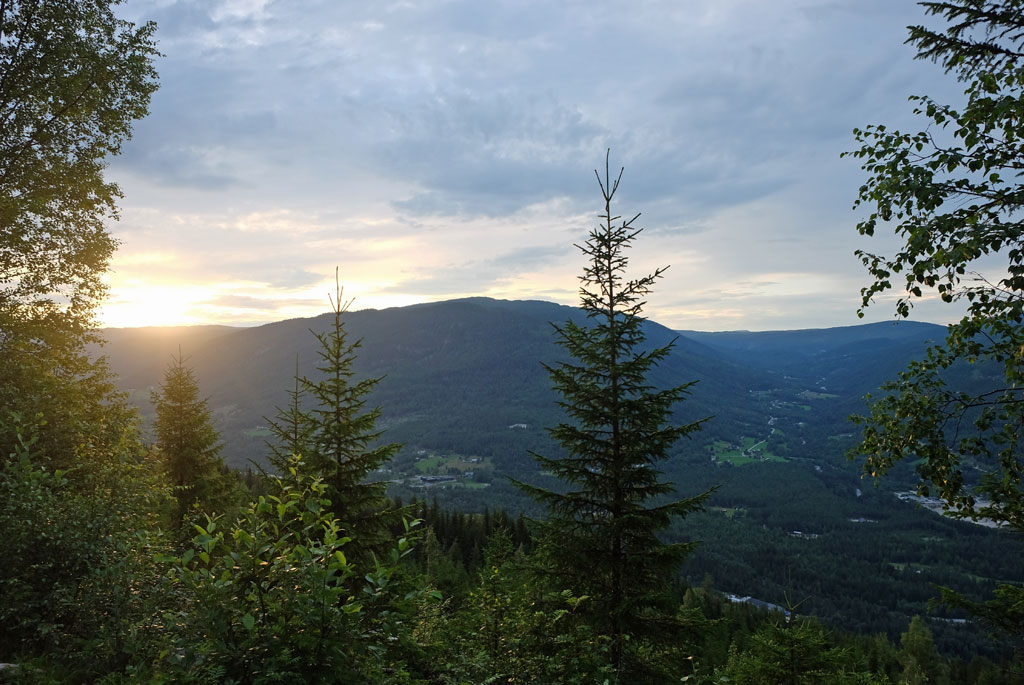
Setting sun from my campsite at Buverudåsen.

<< Bråtådokktjønn // day 1Rjukan // day 3 >>

Monday, July 12, 2021

De Kvite Kyrkjene // day 1 // Krosshøl - Bråtådokktjønn

De Kvite Kyrkjene pilgrim path, day 1.
Distance: 22.2km (27.3km).


From Tinnoset the proposed way to get to Sandviken, from where the pilgrimage continues on foot, is to take a boat. Although the prospect of a boat ride is nice, pilgrimages to me is still about walking.

Holkåe, passed by on the way down towards Rauadammen.

Which means I need to find another way to get to the bay. My first plan was to try to locate a path in the hills above Tinnoset, which could connect with another path that would get me there. The problem is that those two paths are not connected, and I had to hike through a rather cumbersome terrain by the look of the map.

Rauadammen.

Instead, my parents will drive me to Krosshøl, from where I can walk down to a parking lot near Rauadammen. From there I can find an alternative route to Sandviken, which also has been waymarked with the pilgrimage sign (a white church).

Rauatunnelen.

The beginning of the Rauafossen waterfall, with the channel directing the timber into the Raua tunnel.

This alternate route is actually a pretty nice and interesting one. Rauadammen was originally a wooden dam that was replaced by a stone dam in 1883. The 100-meter-long dam lies at the outcome of the Reisjå lake, which was used to transport timber all the way down to Tinnsjøen. It is estimated that in the 1900s about 36 000 timber logs was floated down Rauavassdraget each year.

Path down towards Tinnsjøen from Rauadammen.

Most interesting is the dark and huge maw of Rauatunnelen. The Rauavassdraget watercourse ends up in the violent Rauafossen. So in order to take the timber safely past the waterfall, a 60 meter long tunnel was built. Going down to the tunnel I can follow the channel leading the timber into open maw, with water gushing rapidly down and into it. You do not want to fall down into that gaping black hole.

Almost natural steps on the path.

I had a late start, so the sun was lower on the sky while I walked down towards Tinnsjøen, illuminating the path with a warm light. The path is meandering down through lush forest between moss-covered stones. Occasionally the roar from the gushing river in the gorge below can be heard.

Tinnsjøen, looking over at Sandviken from the outcome at Rautangen.

I arrive at Sandviken at around six o’clock in the afternoon, with the last part of the walk going next to Tinnsjøen lake, albeit with most of the view of the water through trees. The terrain on this stretch was more cumbersome, with the path taking its turns up and down protruding rocks. It was still a very nice walk in a fine light.

Path next to Tinnsjøen towards Sandviken.

At this hour Sandviken might for many be a perfect place to stop for the day and make camp, here I find a large picnic table formed like an arrow with benches, a campfire pan and stack of firewood. Further up in the woods there is an outdoor loo. All with a stony beach and a lake to behold.

Sandviken, picnic benches and campfire pan.

The next church, and hence in a way the endpoint of this stage, is Hovin church, which is a walk of about ten kilometres from Sandviken. Sandviken was once a small farm close to being a hamlet, in 1900 there was 11 people living here. Somewhere between 1920 and 1930 it was abandoned. As I walked past the worn and dilapidated buildings, I could see that there are some maintenances being done. The only access way to the farm, with the exception of boats, is an uneven, rocky and steep carriage path that the pilgrim path also follows.

Derelict buildings at Sandviken.

Steep carriage path from Sandviken.

After having followed the carriage path through a nature reserve, past the quiet small lakes of Nordre and Søndre Bratterudtjønne, the route changes to a more even gravel road. This road eventually becomes the part of the pilgrimage that is going closest to the lake. The walk is pleasant, passing by farms, overlooking the lake and the mountains behind, but at the end I grow a little bit tired of it.

Søndre Bratterudtjønne.

Quiet is the word at Hovin church. The timber church standing here today was consecrated in 1850, but there has been an older one here before, possible dating back to before 1730. It has gotten late, with the clock already having passed eight, and I am wondering about where I will sleep tonight. Not on the church grounds obviously.

A hare on the path.

After having a break at the church, I continue on the pilgrimage path past some farms above the church on what appear to be another old carriage track. Passing by the last farm, I head up into the woods and hills at the same time as the sun is about to set. The path has from the church alternated between paths and gravel tracks.

Walking past farms next to Tinnsjøen.

There is a serene feeling descending upon me when I go up into the woods. Kind of the feeling you get when it is getting late, you are tired, and you know you are getting closer to your destination. While at the same time the walking is pleasant and you feel that you can walk on. The colours of the sky is warm from the setting sun. Getting higher up, the trees are opening up and I could see the evening sun just above the mountains in the west. I look around for places to camp.

Hovin church.

Instead, I push on, having somewhat made up my mind to reach the small lake of Bråtådokktjønn at Ramnskardåsen as a place to pitch my tent for the night. The top of Ramnskardåsen is defined by larger spaces between the trees, a lot of pine trees, with moss, heather and rocky outcrops. Between the trees I spot the small lake.

View of Tinnsjøen above Hovin church.

Enclosed path by vegetation after leaving Hovin.

It is a nice place to camp, a scenic lake in pleasant surroundings, but there is a catch. A hoard of mosquitos and gnats are just as happy to be here as I am. I prepare and eat dinner while the sky is providing some nice colours. At intervals, I feel the need to move a little bit around to escape the attention of the tiny blood suckers.

Light from the setting sun.

In all, quite a good day. The sort of prologue from Gransheard to Tinnoset was pleasant. I was very satisfied with the walk down to Tinnsjøen from Rauadammen, which was both scenic and interesting. The remaining walk to Hovin church was for the most part nice. And it ended with another satisfying walk up into Ramnskardåsen with trees coloured by the setting sun.

The path up into Ramnskardåsen.

I have no idea how far I will go tomorrow, how exciting!

Bråtådokktjønn.

<< Tinnoset // day 1Buverudåsen // day 2 >>

De Kvite Kyrkjene // day 1 // Gransherad - Tinnoset

De Kvite Kyrkjene pilgrim path, day 1.
Distance: 5.1km (5.1km).


‘De Kvite Kyrkjene’ is a pilgrim path that goes around the Tinnsjø lake in Norway. The main pilgrim objective is to visit the six white churches that are situated around the lake. These are Atrå, Dal, Gransherad, Austbygde, Hovin and Mæl. The entire route is about 90km long. More info about the pilgrim path can be found here.

Gransherad church.

Originally, I was not entirely convinced that this route would provide enough attraction to me to want to do it, but then I decided to give it a try. My biggest concern regarding this pilgrim path was the almost necessarily need to make use of boats to be able to do it in a convenient matter.

Tinnåe.

The recommended place to start the pilgrimage from is Mæl church, where you are to take a ferry (Storegut) to Tinnoset. From Tinnoset, the first walking stage will take you to Gransherad church. It is here that I get one of the misgivings of this pilgrimage, since you are to walk back again to Tinnoset from the church. And then having to rely on a local boatman to take you to Sandviken as there are no walking paths between there and Tinnoset.

Standing on the disused Tinnosbanen railway, the pilgrim path does not go on the actual railway though.

It is possible to get a key to the churches, but if I was to do this pilgrimage, I decided that I did not want to deal with the additional necessary appointments to retrieve and return the key.

Knitted waymarker of De Kvite Kyrkjene pilgrim path.

Dealing with not wanting to use a boat to get to Sandviken, I had studied the map and located some paths that I could make use of. The problem was that I had to walk a section without a path for this work, in a terrain that on the map appeared to be very cumbersome. Thankfully a solution arrived in the form of my parents who could drive me to another entry point to Sandviken from Tinnoset. They would anyway drive me to my selected starting point at Gransherad church.

Nattejuv.

After dropping me off at Gransherad church, my parents will drive to Tinnoset to wait for me there. It is about five kilometres for me to walk and since I walk light-weight, I believe I can make it there in about one hour.

Peculiar section of the pilgrim path going through a tunnel underneath the disused railway line, under some sort of maintenance.

The waymark sign of this pilgrim path is a white church. These are found on the trail either on wooden signposts, painted on the trees or rocks or as knitted patches.

Marshland below Nattejuv.

Gransherad church dates back to the Middle Ages, but the present church was consecrated in 1849. For those in need of a last-minute re-supply, there is also a shop here (however, there are more shops later on the pilgrim path). From the church to Tinnoset the pilgrim path follows a locally waymarked route mostly going on good paths, both narrow and broad.

Walking through grass on a field before Nisi.

When arriving at Tinnoset, I have passed underneath the hauntingly named Nattejuv (‘Gorge of the Night’) hill, walking close to a small section of marshland, after a short climb going past a loft getting some views of the other side of the valley due to timber work and passing by the farm of Nisi.

After Nisi farm.

A pleasant walk, but most excitement was found when the path went near the disused railway line of Tinnosbanen. This was once a line used to transport fertilizer to Skien from the fabric Norsk Hydro had at Rjukan, but it was also used for personal transport. It went operational in 1909 but was disused in 1991.

The old Tinnoset railway station.

Tinnoset is where the Storegut ferry is having its terminal. As expected, I only used about an hour, meaning that my parents did not have to wait too long for me. They had spent the time by having lunch and taking a look at the old railway station and ferry terminal. Good thing the weather is nice.

Tinnoset.

Bråtådokktjønn // day 1 >>

popular posts