Thursday, September 6, 2012

GR20 // day 5 // Monte Cinto

Distance: 12km, altitude at start: 1422m, altitude at end: 1422m, highest point: 2706m.

It poured down during the night. In the morning though, there are almost no clouds on the sky. Only far down in the valley below Haut Asco can I see any. My legs are itching, the wait is over and I can finally continue to walk again. That is, I only have to climb a mountain first. Monte Cinto is the highest mountain on Corsica with its 2706 meters above sea level. Those 2706 meters and the Cirque de la Solitude have stood like a buffer between me and the rest of the GR20 for some days now.

The valley up along the Ruisseau de Tighjettu. No menacing clouds over the valley. Only a green and lush valley that changes to bare rock where the mountains breaks loose from the vegetation.

The valley up along the Ruisseau de Tighjettu appears quite different now that the heavy cover of clouds has vanished. Even the sound of the water that runs through the river seems more relaxed. By the bridge over the river I can now clearly see the towering spires over me, mighty as they are. I pass a large group of Germans on my way upwards, the very same group that I met when I was at Refuge de Sega.

View back down towards the Asco-valley.

The trail is going steep upwards between La Tour Penchee, which is hanging leaning over the pass, and Capu Borba. I can see in direct line up at Monte Cinto. Haut Asco far below has hidden itself behind a spire of rock, the sun likewise. There is a lot of shade here in the start of the day. Some parts demands scrambling over stone and rocks. Looking back at yesterday's ambitious plan I think it was the right decision to turn back.

A group of wanderers on their way up to Monte Cinto beneath Capu Borba. I later climbed up on top of the little spire behind the group.

I pass the Lac d'Argentu before the trail now gets even steeper and goes up towards the ridge below the top, over scree and some big rocks. I catch up with the couple that also took a shot at Cinto yesterday. At the top of the ridge there is a great view. I can see the summit, which lies just a little bit away now, but I can also see the weather to the south that has been kept hidden from me so far. That is, I can't see anything at all. To the south of Monte Cinto is a huge cloud system that hides anything behind it.

View back towards the little valley I've climbed up from on my way up to Monte Cinto.

Instead of following the ridge to the summit, the path now descends down on the south side. And it's a little bit of an awkward path between big boulders that has to be passed, inside the layers of clouds. After a while it goes up again and I can again look over the clouds. There the summit of Monte Cinto towers over me and after a short time I'm standing on the top of Corsica. The view to the north is fantastic; the view to the south is all white. But, in between I get small glimpses of what hides behind the white horizon. I can see Calacuccia, which is an artificial lake, emerge from the veil.

On the top of Monte Cinto, 2706m.

A bird with a view. View to the north from Monte Cinto.

To the north I can point out where the trail goes over the mountains to Haut Asco. Mighty mountains in the distance, and Calvi. Yet, what I was most interested in was to look to the south and be able to see in the direction where I'm going towards. Towards Paglia Orba not the least.

View from Monte Cinto.

A small party has gathered on the top now, and while I enjoy my lunch I can hear several different languages around me. A flock of ravens lands besides me, looking for crumbs. The sun is now warming. Far below lies the little lake, Lac d'Argentu, like an eye and looks up at me. I stay at the summit for over an hour. To the north, some clouds are drifting in over the mountains.

View back towards Haut Asco, the mountains that I've passed over and the valley with the little lake Lac d'Argentu beneath the top.

On the way down again I meet the group of Germans not far away from the top. In the direction of the Cirque de la Solitude trails of clouds are reaching up between the tall spires. I pay a visit to the clear and green waters of Lac d'Argentu on my way down, but no bath this time.

Lac d'Argentu.

Below Capu Borba a small spire is standing, on the other side of the valley from the leaning La Tour Penche, which I climb on top of. From the rock you can see straight down on the landscape below. More clouds over Monte Cinto in the background now, the evening clouds have announced their arrivals.

View up towards Monte Cinto on the way down. La Tour Penche towering to the right. The trail goes up along the mountainside to the left in the picture.

I feel it's necessary to celebrate with a cold beer on the terrace when I'm back at Haut Asco. From here the summit is now partly covered by clouds. Less people around as well, most of the people that has been here waiting for better weather has now taken the opportunity to pass the Cirque de la Solitude and continued on the GR20. It awaits me tomorrow, which I'm really looking forward to. This was a great day, which was crowned on the top of Corsica.

<- Haut AscoU Vallone ->

Wednesday, September 5, 2012

GR20 // day 4 // Haut Asco

It's gray and heavy weather outside, not much lighter as the weather forecast predicted. Despite of the conditions I've decided to start hiking up towards Monte Cinto, with a small hope that the weather will be better. Mike and Zoe have decided to move on and do the Cirque de la Solitude in the rain. After saying goodbye I start walking into the fog.

Heavy clouds drift between the trees above Haut Asco.

The grey weather lies menacing over the valley, peaks emerges from the fog high above. There are no signs of any kind that the weather will lighten up. Deer are scuttling away just above me. I cross the bridge over Ruisseau de Tighjettu. Then the path goes steep upwards and I have to do some scrambling to get further. The wet stones make the surface slippery. I admire the towering spires that lean above me, only the peaks can be seen.

A grey landscape on the way up towards Monte Cinto in the valley along Ruisseau de Tighjettu.

After scrambling a little bit upwards it starts to rain. From here I can't even see Monte Cinto. I probably won't see anything from the top and I reckon that going down again could prove to be quite demanding. I decide to turn back. A little way down I meet two boys from the Czech Republic that also wanted to have a go at the summit. They keep on walking upwards, I continue down again. It rains even more now. Then I meet a couple who has planned to go up to the summit and then on to the Refuge de Tighjettu. They keep on walking upwards, I continue down again. I know I'm going to be mad and envy them if they do get up and gets a view above the clouds.

Deer in the mountains around Haut Asco and Monte Cinto.

I spend the rest of the day at Haut Asco, waiting. To keep me occupied I put my tent up for drying, goes for a walk to a little summit above the ski station, drinks Pietra, eat dinner and reads in my book. Later on I meet the two Czech boys and the couple, they'd all turned back almost at the same spot that I turned back. I go to bed with the rumor of nice weather the next day.

Dark spires emerge from the clouds above Ruisseau de Tighjettu.

<- IntermissionMonte Cinto ->

Tuesday, September 4, 2012

GR20 // intermission // Corte, A Boucle Des Deux Vallees

After three days on the GR20 it is full stop, even if it's nearly no clouds in the sky when I'm looking out of the tent friday morning. It's forbidden to walk and I, among others, am a little bit confused. After a lot of ifs and buts the result is that I take the navette down to Ponte-Leccia together with Laurits and Agnes (and lots of other hikers). But when it leaves Haut Asco I have a feeling that it's a wrong choice. But the choice is made, and from Ponte-Leccia I take the train to Corte, the former capital of Corsica.

Out from Corte.

So, I get an intermission from GR20 and I'm being relegated from being a hiker to being a tourist again. However, I get my first hot shower since leaving Ajaccio four days ago. Corte is a very nice town, but you get to see what it has to offer during one full day. The highlight being the view from the top of the castle, which itself is located on a cliff on the top of the town.

Cut off from the GR20 my hiking gaze is set upon the two valleys that goes up to the mountains from Corte, the Restonica and Tavignanu valleys. On saturday (I arrived yesterday on friday) I decide to do a one day hike up to the Refuge de Sega, which is located in the Tavignanu valley. From Sega you can get to the GR20 by following a trail that goes up to the Refuge de Manganu. It's about five and a half hour up to the cabin, but I'll probably spend a shorter time since I'll walk with a lighter backpack.

The Tavignanu valley. The path is winding itself up through the valley with mountains on both sides.

The Tavignanu is a beautiful valley which follows the river that carries the same name, up towards the mountains high above. There are no roads in the valley, so if you want to see the valley your feet are your only way of transportation (going on horse could probably be arranged). I'm not alone with the idea of hiking up to Sega. A little way up in the valley I meet Mike and Zoe, a couple from Australia that also left Haut Asco yesterday, and we walk together the rest of the way up to the cabin. The trail is almost always going upwards, but it's easy and nice to walk on. Just before we arrive at the cabin it starts to rain. Dark and ominous clouds lie over the mountains and the GR20 further up.

Refuge de Sega.

The Refuge de Sega is located in a very nice spot alongside the river, which contains some really tempting pools. The inside of the cabin is much more spacious than has been in the cabins so far on my journey. We eat lunch on the terrace outside the cabin, a little cold after the walk in the rain. People have begun to come down from GR20. People were being sent down from Ciottulu di I Mori due to the possibility of snow we were told. There is thunder in the distance.

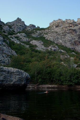
Little, black and yellow reptiles are scuttling over the path when we are starting the walk down towards Corte again. Where the sky is pitch-dark over Corte down below, there is now sun over us. By Punta Rossulini I take a bath in the pools beneath the bridge. I arrive at the mountain town with thunder breathing over my neck. I meet up again with Mike and Zoe for a drink in haute ville de Corte, while the thunder weather is released upon the town. The weather forecast has now extended the days of bad weather apparently. Truth be told, I'm a little bit frustrated by the news, despite having had a nice trip up the Tavignanu-valley.

A curious black and yellow little creature, that emerged when it rained.

Thunderstorm over Tavignanu.

I decide to use the extended break from GR20 to do 'a boucle des deux vallees'. It's a two-day hike that goes from Corte to Refuge de Sega through the Tavignanu-valley, for then to go over the Alzo-plateau to the Restonica-valley and down back to Corte again. This means I'll go up to Sega again. As a diversion from yesterday I take an alternative route towards the cabin after Punta Rossulini, this path goes on the right side of the river. As with yesterday it starts to rain just before I arrive at the cabin.

Punta Rossulinu. Nice pools in the Tavignanu-river that runs under the bridge.

I spend a nice evening at the cabin, while the rain is pouring down outside. Less nice is it at night when I awakes at two o'clock and has to go outside the safe confines of my tent. When I look out of the tent I see that there is almost a full dam or river underneath it. It's raining heavy and the soil is unable to keep up with all the water that is coming. The morning after the water is gone, but the tent is standing left soaked and dirty. Luckily it had stayed dry inside, I'd be able to keep the water outside. Above me, the clouds are drifting through the trees in mountainsides.

Raindrops are shining in the sunlight on my way up towards the Alzo-plateau. More of the weird black and yellow creatures are seen crawling on the path. Smoke rises from a tree, created by the warmth given from the sun. The ruins of a bergerie are passed. Over the Alzo-plateau the fog is coming gliding towards me and descends upon the landscape like a moist blanket, mythical beings are walking hidden from the eye in the mist. A fairy atmosphere. The Bergeries d'Alzo is quiet, doesn't seems to be anyone there now. I pass several other farms. The trail disappears into the clouds on the way down towards the Restonica-valley.

Bergeries d'Alzo in the mist.

Fog drifts in over the Alzo-plateau.

After walking a while autumn colors emerges from the mist and I can see the valley beneath me. I can see in up in the direction of Bergeries de Grotelle where the Restonica-valley goes, from there the valley goes further up towards Lac de Capitellu and Lac du Melo. GR20 lies above those twin lakes. Through the Restonica there is a road and I follow it down to Corte. I missed where the waymarks left the road, no sign marking where, so the rest of the walk is made on the asphalt. The waymarks disappeared quietly without a sound.

View up in the direction of the GR20. Inside the clouds at the end of the Restonica-valley lie Lac de Capitellu and Lac du Melo, deeper into the fog the GR20 goes between Manganu and Petra Piana.

Back in Corte after 'a boucle des deux vallees', which was a nice hike through the two beautiful valleys, I'm met with the news that the bad spell of weather will be extended further. The bathroom floor becomes the target of most of my fury when I spread the soaking wet tent all over it for drying. I decide to go back to Haut Asco the next day (tuesday 04.09) anyway. It's been nice to walk in the morning here so far, the bad weather has come in the afternoon.

The Restonica valley emerges from the clouds.

By Ponte-Leccia I meet up again with Mike and Zoe, it looks like we're having the same line of thoughts. The navette that goes up to Haut Asco doesn't leave until later in the day, so we get to explore the little place. They've got a disco bar here, which we inevitable ends up at. Where the disco are I can't actually tell. The sky is literally opening itself, rain is pouring down by the buckets.

Back to Corte after having walked down the Restonica valley.

It's grey and dull weather back at the old ski station, but it feels kind of good to be back. I've been five days away from the GR20 and I'm anxious to get going again. We'll see what the next day brings.

Corte. The old castle lies on the top of a rock and guards the old capital of Corsica.

<- Haut AscoHaut Asco ->

Thursday, August 30, 2012

GR20 // day 3 // Carozzu - Haut Asco

Distance: 6km, altitude at start: 1270m, altitude at end: 1422m, highest point: 2010m.

I sort of roll out of the tent more than walk out of it. And then gets a brutal start on the day with a visit to the toilet, you spend more strength on the toilets along the GR20 than you use on the walking. The breakfast is just like yesterday lying ready for me inside the cabin.

Passerelle de la Spasimata. Agnes on her way over the suspension bridge. Not much water left in the river now, this late in august.

The gardien at the cabin reported yesterday that a storm was coming today, so I'm off earlier than yesterday. Typical for the weather down here is that the clouds and bad weather usually tends to come later in the day. About an hour after leaving the cabin I come to the suspension bridge that goes over Ruisseau de Spasimata and I know that I've got the highlight of the day before me. The passage over the Spasimata slabs up towards Bocca a i Stagni.

There is so little water in the river now that you can just as well walk over it to get to the other side, but suspension bridges are fun so I enter the little queue that is to walk over by it. Clouds are now high up in the pass above. Then the hike up the Spasimata valley starts.

The Spasimata slabs. The trail ascends up and over the massive slabs of stone towards Bocca a i Stagni, layers and layers of granite.

The ascent goes up over the Spasimata slabs and there are chains available most of the way. In rainy weather the stones get really slippery quite fast and some places turns into death traps (apparently) where you risk falling down into the abyss below you if you should be unlucky to slip. Now, however, is it completely dry and so the chains are more like decorations. Well, some uses them anyway, not all of the hikers are just as confident going over the slabs. The abyss lies threatening to one side of the trail.

View down towards the Spasimata valley. The slabs lies like lego bricks stacked upon each other above the river.

It's really cool going upwards. The slabs lies on layers upon layers, like a huge staircase for giants up towards the pass above. In the middle of the valley a cleft is breaking through the slabs with the river running below. The river will probably soar down the valley during springtime. Now it's just quiet, a quiet echo from the past.

A chopper breaks the silence, further down the valley the little bird of steel goes flying up towards Carozzu with materials. I catch up with Odd and Gro, the other Norwegian couple that I've met. We enjoy a break together while enjoying the vistas in backwards direction.

Lac de la Muvrella. After climbing up all the slabs on my way here I couldn't resist taking a bath. Cold, but refreshing.

Up by Lac de la Muvrella the Spasimata slabs traverse is finished, but the ascent isn't over. It's still steep up towards Bocca a i Stagni. But before taking on the last climb, I go for a swim in the water. The water can't be said to be very clear, nor is it hot. It's still refreshing though after all the sweat I left behind slab upon slab. Muvrella is by the way the French word for mouflon.

The view at Bocca a i Stagni (2010m) is as expected, fantastic. And now Monte Cinto is almost alongside us. I turn my gaze towards where the Cirque de la Solitude lies and awaits me. Looking down, the path goes very steep downwards, far below lays the old ski station of Haut Asco. Up to Haut Asco there is a road and I can see cars stand parked alongside the hotel. The civilization awaits, I can't manage to stifle a little sigh. You can understand the some people choose to go the old route that bypasses the ski station.

Bocca a i Stagnia, view back down from where I've climbed up from. Lac de la Muvrella down to the right, Calvi still seen in the horizon upper left.

After a long (and steep) descent my feet touches asphalt. I meet up with the French group again for a beer and an omelet for lunch in the restaurant at the hotel. It's the civilization, but it brings good food with it at least.

Steep down towards Haut Asco.

Refuge de Ascu-Stagnu is a really sad building in concrete and it's just as sad on the inside. But the gardien here is anything but, she was a fantastic nice, warm and attentive woman. On the sign outside of the cabin it says hot showers, but it's as expected ice cold. Yet, it's nice to get a cold beer on the terrace outside. Just as nice isn't the news the gardien brings, the weather forecast for the next four days are very bad, heavy storms are on their way. Gloomy views in other words. The storm that should come today has still yet to come.

I eat dinner together with Laurits, Agnes, Gro and Odd at the hotel. Melon with Corsican ham as starter, duck with pommes frites, ratatouille and salad as main dish and tiramisu as dessert. The food was excellent. Something to make up for the bad news, the path is apparently closed tomorrow. It's forbidden to walk. The weather forecast is storm, rain, heavy wind, thunder and even snow in the next days. Not the weather to hike to the summit of Monte Cinto or through the Circue de la Solitude.

View down towards the valley below Haut Asco.

Todays stage was a nice walk, with the Spasimata slabs as the highlight. Yet, not as exciting as the two previous days.

<- CarozzuIntermission ->

Wednesday, August 29, 2012

GR20 // day 2 // Ortu di u Piobbu - Carozzu

Distance: 8km, altitude at start: 1570m, altitude at end: 1270m, highest point: 2020m.

Morning dawns and many have already started walking when I wake up and goes to the cabin to eat breakfast. Inside, the breakfast is ready, a plate with my name on it. The breakfast is typical for the trip, light bread, jam, a hot beverage and maybe some orange juice. But in addition, the gardiens here has been so nice to include three big slices of cake. I sit down on the terrace and eat the meal while enjoying the view from the cabin.

A herd of goats descended from the mountain and invaded the Refuge d'Ortu di u Piobbu in the morning shortly after I left.

Down from the cabin, tents and backpacks are being packed together. Others are starting the walk towards Refuge du Carozzu. Some are walking towards Calenzana and for them the end of their adventure on the GR20. There are almost no clouds in the sky, all look set for a nice day. A lady screams hysterically when a loose horse gets too close. Quite mischievous, the horse had previously attacked the bag of food belonging to some other hikers earlier. While the horse ate pieces of plastic, small portions of coffee lay all over the ground.

After passing the water source for the cabin, which is located a little bit outside of the area, the path goes up and into the woods. Further ahead when I look back at the cabin, a large herd of goats has nearly surrounded the cabin. The path goes around the ridge above the cabin and then down through birch- and laricio-trees. I pass the ruins of a farm (Bergeries de la Mandriaccia) while the sun is shining on the peaks above and around me, and then I begin the climb up towards Bocca Piccaia. More goats are grassing in the mountainsides.

View from Punta Piccaia (well, almost) and down towards Bocca Piccaia. The GR20 is heading off up towards the ridge on the other side and then winds itself further along the ridge in the direction of Bocca Innuminata.

Up by Bocca Piccaia (1950m) the sun has overtaken me. The view is absolutely fantastic. On one side it goes steep down to the valley below, not that it wasn’t steep up to the pass either. A nice and convenient place for a break, other walkers are sitting everywhere. There is a little murmur among the people when I make my way up towards Punta Piccaia (2012m); my curiosity has gotten the better of me again. But it turns out to be a futile attempt, to get to the top from this side demands a lot more climbing than I’m ready for without proper equipment. However, the view from here is even more spectacular than from the pass below (Bocca Piccaia).

View down towards Bocca Piccaia, Punta Piccaia and far off Calvi. I made a summit bid for Punta Piccaia, but had to give in due to the extremely steep last part.

The trail continues along the ridge below Capu Ladroncellu (2145m), distinctly marked by the red and white paintings. You could easily come from Monte Corona and go over to Capu Ladroncellu and then get down to the path from there again. In the valley below, the forests of Bonifatu are visible around the mountainside. Monte Cinto is towering closer and closer for each step.

Spectacular mountainscape between Ortu di u Piobbu and Carozzu.

The path is following the ridge below Capu Ladroncellu.

After I have passed Capu Ladroncellu above, the trail between Bocca Piccaia and Bocca Innuminata is going from one side of the ridge to the other. The view changes from side to side, on each side you get rewarded with fantastic views of mountains and valleys. It’s a rollercoaster in mountain and stone. By Bocca d’Avartoli it is time for some food, the view tastes almost better than the food.

Down towards the ridge and Bocca d'Avartoli between Bocca Piccaia and Bocca Innuminata.

At Bocca Innuminata, at 1865m, I can look back and see the trail clearly against the mountainside and curling itself around the ridge and towards the pass where I’m at. From here it goes steep downhill to the Refuge de Carozzu. The path down to the cabin consists of scree and loose stones. I catch up on Laurits and Agnes on my way down, they had started early to get away from most of the heat during the day.

The Refuge de Carozzu is just like the previous cabin quite basic inside, but it has a very nice terrace outside. From the terrace there is a great view down towards Bonifatu. Places to pitch my tent by the way, is however not easy to find. Since I started later than others and again took my time during the walk, I arrived later than most of the other wanderers and the best (and most) spaces are taken. At last I find a spot inside the woods, but it’s definitely not on level ground (if rain comes it will be quite chaotic).

Bocca Innuminata, which is also known as Bocca Carozzu. Looking back I can see the trail where it goes down from the mountainside beneath Capu Ladroncellu, then winding itself along the ridge until it ends up at this pass that lies above the Refuge de Carozzu.

Unfortunately, not finding a place for the tent isn’t the only problem here. There is a shortage of water, and the number of walkers doesn’t make it easier. After standing one hour in the queue for the shower (one shower and people are using 10 minutes), I give up. Instead I fill my camelbak and bottle with water, and make my own shower out in the woods. Later, when I’m walking whistling by the queue, it doesn’t appear to have moved an inch. After one and a half hour later there was no water left.

Dinner at Carozzu, I eat dinner (pasta with dry sauce) together with the same group that I ate with at Ortu di u Piobbu: Bruno, Francoise, Veronique, Pascal and Brigitte.

The dinner is also affected by the lack of water; the pasta sauce is kind of very dry. It’s good to get a Pietra to quench the thirst by then. Despite the seemingly chaos at the place it turns out to be a nice evening. The sky turns fiery red when the sun goes down behind the mountains. The prayer flags are blowing in the wind. Darkness descends upon the cabin, from the woods you can hear voices from the various tents hidden beneath the trees.

The clouds are covering the hills above Bonifatu. Laricio-pines emerge from the mist.

The stage between Ortu di u Piobbu and Carozzu was an incredibly great walk where the trail wound itself on each side of the ridge with beautiful views to mountains and valleys on each side.

Evening at Refuge de Carozzu.

<- Monte CoronaHaut Asco ->

Tuesday, August 28, 2012

GR20 // day 1 // Monte Corona

Distance: 5km, altitude at start: 1570m, altitude at end: 1570m, highest point: 2144m.

After arriving at Refuge d’Ortu di u Piobbu I've got a lot of time at my disposal before dinner. Back home in Norway I’d planned to hike to the top of Monte Corona after finishing the first stage, not knowing if it was an ambitious plan or not. Standing ready to go, it wasn’t being tired that would make up most of the hindrance, but the weather.

Refuge d'Ortu di u Piobbu as seen from the way up towards Monte Corona. Still there are clouds hanging over the landscape.

Drifting up from the sea the clouds had come soaring and engulfed the cabin and the surrounding landscape. The top has disappeared beyond a grey veil. The possibility to see anything from the summit is looking kind of small. I have a lot of time to spare before dinner however. So, I decide to make a go for it. If not, just a little bit upwards to check out the conditions.

View to the south from Monte Corona. That will be the landscape that I will see the upcoming days.

I leave the cabin and makes my way through the birch woods above the cabin, by the side of me wisps of clouds is floating between the trees. The path winds back and forth up towards Bocca di Tartagine. Among the yellow leaves yellow markers points me in the right direction. Up by the ridge, the clouds has dissolved and the sun is now smiling again above. The view unfolds before me, backwards and downwards towards the cabin I’ve left and over to the ridge on the other side of the valley. Far down below I can see a road.

It’s an easy walk from the ridge and up to the top, from the top I can look out over the landscape in all directions from 2144 meters above. A small camera is mounted to a solar panel; I give the viewers in the other end a smile. Down in the valley I can see the cabin with all the tents like small dots around it. Calvi again in the distance, it will not be the last I see of the city.

View towards Calvi from Monte Corona, Ortu di u Piobbu lies below about in the middle of the picture.

But the greatest excitement lies to the south, and what I can expect in the following days. From where I stand tall spires reaches upwards one and one after each other, with some small ridges in between. It’s steep and magnificent. I can see Monte Cinto reaching to the sky, and hopefully I will be standing on top of it in a couple of days and can look back towards here. Monte Corona may not be as spectacular as other summits here, as it’s quite easy to summit, but it made the highlight of the first day.

Monte Corona. View towards the top from the Refuge d'Ortu di Piobbu.

<- Ortu di u PiobbuCarozzu ->

GR20 // day 1 // Calenzana - Ortu di u Piobbu

Distance: 12km, altitude at start: 275m, altitude at end: 1570m, highest point: 1570m.

Early morning a late august day in Calenzana. A quiet sigh from the watch is indicating that the time is four o’clock in the morning; I can hear voices in the dark outside of the tent. People are already up and are anxious to get going. So am I, but it is way too early in my opinion and I withdraws back into my sleeping bag. By the time I finally wakes up, a lot of people have already started walking.

I’m not the only one from Norway here. I've met two other couples here who are also here to walk the GR20, Laurits and Agnes, and Odd and Gro. However, they’ve only planned to walk the northern part, Odd and Gro has previously done the southern part.

Early in the morning. People are making ready to leave at the Gîte d'Etape in Calenzana.

And so at last am I at the start of GR20, the iconic route that traverses over the mountains of Corsica from north to south. Ahead of me lies 190km of rock and mountains. I can’t hide that I’m quite excited when I’m heading out of Calenzana in the direction of Conca. But, I won’t be there before several days from now on. Today the walk goes to the Refuge d’Ortu di u Piobbu, and it’s uphill all the way. The sun is still hidden behind the mountains above me when I follow the red and white markers in the morning light. The path goes up through the hill between maquis, pines and chestnut trees. I’m finally on my way, and soon Calvi (which will follow me for a long time in the distance) is visible in the horizon. Down below is Calenzana looking up at me where I’m moving towards the mountains, just as to say that it's still not too late to turn back.

Calenzana. On my way up towards Ortu di u Piobbu and my first day on the GR20. Nice weather, walking in the shade for the most of the day.

A couple of hours after walking round the serrated ridge of Capu di u Ravalente and moved upwards through woods and stone, I emerges from the shade at Bocca a u Saltu (1250m) and, finally, to the sun. Too late to meet the foreign legion going off on their seven days traverse of the path, but not too late to be able to enjoy the great view. Uninterrupted by clouds. In the horizon the sea and sky paints the background blue. The arms of the mountains reach upwards from the landscape. At the pass I meet Laurits and Agnes again. The view demands for a break in the beautiful weather. Afterwards we go together the rest of the way.

Up towards Bocca a u Bassiguellu I come to the first parts that demand some easy scrambling. I leave the chains untouched, in this nice weather there is no use for them. Lizards are scuttling everywhere. The sun is warming now, but there are clouds on their way over the landscape, drifting in from the sea. Monte Corona is seen rising on the other side of the valley, emerald colored, when I pass under the Crête du Fucu. Refuge d’Ortu di u Piobbu lies beneath the mountain, I can see that many have already reached the cabin and have pitched their tents. Nothing else to expect though. The path was closed between Calenzana and Haut Asco for three days before I arrived due to forest fire danger, there were many people waiting to start walking this day. Though, somebody didn’t care about it and walked anyway.

The way up towards Capu di u Ravalente.

At the waymark between the GR20 (Fra Li Monti) and the Tra Mare e Monti. By following the Tra Mare e Monti trail you can walk to Ortu di u Piobbu by a path that is supposedly easier. This is a low-level variant, that goes through Bonifatu. I do suspect though that going in that direction makes for a hard climb at the end. I choose the high-level route.

When I arrive at the cabin the clouds have drifted in over the mountains, I find myself a nice place for my tent a little way down from the cabin. From the tent I can look up at Monte Corona and the clouds with their grey blankets above. Even though I took my time getting here, I arrived quite early. The cabin is definite more basic than what I’m used to from back home. There’re almost no places to sit inside, but outside there is a terrace with a view. From the terrace you can see down towards Bonifatu and over to the ridge where you passed over coming from Calenzana.

View from Bocca a u Saltu. In the background Calvi and the sea is visible.

After walking up to the top of Monte Corona, it is finally time to enjoy what the cabin has of facilities. First out is to stand in line to get a shower, and we’re not talking about a spa here. For along the GR20 a hot shower is a rarity, but you can get a shower at least. It’s just ice cold though. You can hear people breathe heavily from inside. Relaxing in the sun with a cold Pietra is definitively much more enjoyable.

Bocca a u Saltu. The trail continues along the ridge inside the woods before goes over the ridge and then continues ahead to Ortu di u Piobbu on the other side. Monte Corona in the background.

The dinner is served inside, and now tables and chairs are available. I’m placed together with a group of French people and French speaking which I’m not, I do not understand much of what’s being said. But after a while some English words is spoken and I can take part of a conversation. The food was good, Corsican soup as a starter, lenses with figatellu (a local sausage) for the main course and a rich chocolate cake for dessert.

Walkers on their way towards Bocca a u Bassiguellu. Some parts demanded som easy scrambling.

Darkness descends and when the moon and the stars shines their lights down on Ortu di u Piobbu most of the walkers has retreated to their tents and gone to sleep. I sit down on the rocks next to my tent and enjoy the clear and starry sky, it’s quiet and peaceful. On the other side of the valley, from where I came from, I can see a lonely runner on his way back towards Calenzana. In the dark I can follow the light from his headlamp move together with the landscape. Just after the light disappears over the ridge another six new walkers appears, only their lights visible. Slow, but sure, six small lights is moving along a ridge I can’t see the contours of.

The path winding alongside the Crête de Fucu. Monte Corona to the right in the picture with its green mountainside. Refuge d'Ortu di u Piobbu is situated a little way down below from the top.

Refuge d'Ortu di u Piobbu.

Before I goes to bed for my first night on the trail, I look back at a nice start. The trail up to Ortu di u Piobbu is varied and offers some great views, but it also consists of some nice parts through woods. Not as hard as expected. Steadily upwards, but that isn’t unlike Norway. The hike up to the top of Monte Corona put the finishing touch on my first day in the mountains of Corsica.

Sunset at Refuge d'Ortu di u Piobbu.

Monte Corona ->

popular posts